
Port of Dover Logo. Wikimedia
Dover Harbour Board (DHB) is undertaking major reconstruction of the Port of Dover’s Western Docks. Highly controversial, on completion it will have a major impact on the town and port of Dover economically, socially, politically and environmentally. Within many of the stories of Dover published on the Doverhistorian.com web site, concern has been expressed over the problems of flooding and Alan Sencicle, a member of the Doverhistorian.com team, took this up with DHB. Sencicle went on to write and present a paper on a proposal to DHB and other interested parties. He showed that this could be incorporated into the DHB proposed Western Docks revival scheme in order to help counter Dover’s flooding problem. Eventually the proposal was acknowledged and taken up by DHB. This story explains why Dover has a flooding problem, the development of Western Docks and the Esplanade Navigational Cut.
The story is divided into the following sub-sections:
1. Tides
2. Flooding
3. Western Docks Modern History
4. Dover Western Docks Regeneration / Revival Plan
5. Esplanade Navigational Cut – Alan Sencicle’s proposal
6. The Esplanade Navigational Channel
1. Tides
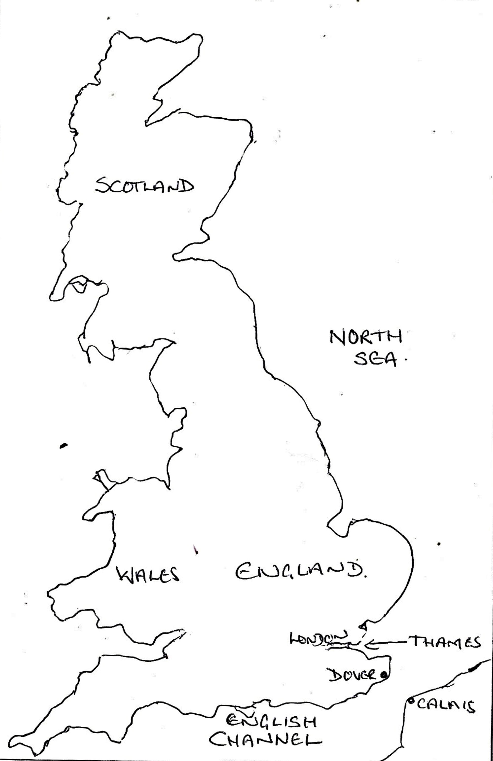
UK Map showing the location of Dover, the English Channel and the Thames
Physically, Dover is situated at the extreme south-eastern tip of the British Isles. It is also the closest seaport to the Continent with Calais, France 20.6 miles (33.1km) the nearest and in between, the English Channel (French: La Manche). The Channel is an arm of the Atlantic Ocean and joins the North Sea off the Thames Estuary. It is about 350 miles (560 km) long, varies in width from the Strait of Dover (French: Pas de Calais) to 150 miles (240 km), and covers an area of approximately 29,000 square miles (75,000 square kilometres). The Strait of Dover has an average depth of about 130 feet (40 metres) whereas the English Channel to the west of the Dover Strait is typically 260 feet (80 metres) depth at its widest part. Because of this topography, the Strait of Dover acts like funnel to both winds and tides, making it notoriously tempestuous.
Recognised since ancient times, the Moon has an important effect on tidal movements. Because of the Moon’s gravitational force it tends to bring the Earth closer but as they both rotate about a common centre of gravity, this has a counter effect. Thus the part of the Earth’s surface nearest the Moon is subject to the greatest gravitational force, but only water on the Earth’s surface is free to move and it is this gravitational pull that creates tides. The actual magnitude of the gravitational pull and the time lags involved vary according to terrestrial conditions so no two places respond in the same way.

Shakespeare Cliff and beach when the (neap) tide is out. LS 2010
Another force involved in tidal movement is the Sun but due to the greater distance involved this effect is much less. Albeit, when the Sun and Moon are in conjunction – during the phase of a New Moon or in opposition Full Moon – the combination of the two forces act together and make the rise and fall of tides stronger – such tides are called Spring Tides. When the two celestial bodies are at right angles to each other, the force is not so strong and the result is what are called Neap Tides. Because there is a time interval involved, in the waters around Britain, spring tides occur 2 days after a New and Full Moon and the neap tides 2 days after the Moon’s Quarters. Finally, because the Moon’s orbit is elliptical, the distance between it and the Earth varies. When they are closest this is said to be Perigee and furthest away, Apogee.
The next factor to be taken into account is Tidal streams. These are the movements produced in response to the above but they are also affected by winds – the stronger the wind the greater the effect. Another factor is the barometric effect, when the atmospheric pressure is low, the sea level is increased and visa versa. The sea level will also be raised on the coast towards which the wind is blowing. Finally, if the sea level is raised in one area, there will be a fall in another. This is a particular problem in the southern part of the North Sea as it causes Storm surges leading to flooding along the east coast of England and on the west coasts of the Continent.
Physical changes both environmental and man-made affect the tidal streams. The first well-documented environmental change in the Dover area occurred at the beginning of 14th century with a major cliff fall at the east end of the Bay. At the time the River Dour estuary had two distinctive streams – the East and West Brook – with the Eastbrook offering the best course to the sea hence Dover’s harbour was there. The Eastbrook harbour was below Warden Down – the cliff on the east side of Woolcomber Street but the cliff fall changed the direction of the Dour westwards and eventually the harbour was moved to that side of the bay.

Tidal streams in Dover harbour, DHB Notice Board – AS 2010
It also caused what is generally called the Eastward Drift – the tide sweeping round Shakespeare’s Cliff began depositing masses of pebbles at the western end of the Bay and by degrees a considerable bank was formed. This changed the direction of the current and during stormy weather breached the medieval sea wall, called the Wyke, leading to flooding. The tides of the Eastward Drift also caused pebbles to be deposited in the harbour entrance, blocking it and rendering it useless. This led to the creation of a new harbour to the west side of the Bay but the problems caused by the Eastward Drift increased with the building of Admiralty Pier in the mid 19th century.
Thus, if there are strong winds blowing from the south-west and the tidal stream is running in the same direction during a Perigee Spring tide. Then there will be an exceptionally high tide with the danger of consequential flooding especially as the lower section of the Dour is tidal. Further, if there is an atmospheric deep depression travelling eastwards past the entrance to the North Sea this, with the combination of tide and wind, will increase the danger of flooding. Then there are the physical changes both environmental and man-made that can and do exacerbate the problem.
2. Flooding

1948 map of Dover showing the present course of the River Dour to Wellington Dock
Dover is famous for its White cliffs, indeed the town nestles between the eastern cliffs on which the Castle is built and the Western Heights. They rise to 350 feet (110 metres) and are comprised of chalk and black flint. The town is traversed by the River Dour, which is just less than four miles long, narrow, not particularly deep and at the sea end it is tidal. The Dour rises between Lydden and Temple Ewell, with a tributary coming in from the Alkham valley. From Kearsney Abbey it flows through the village of River before reaching the town, where it skirts the east side of Pencester Gardens before turning west behind Castle Street. At Stembrook the Dour turns south towards the sea, eventually passing through a culvert under Townwall Street – the arterial A20. After which the Dour turns west, through a deep cutting and at New Bridge enters another culvert under Cambridge Terrace before discharging into Wellington Dock (See River Dour 2a and River Dour 2b)
Since ancient times, Dover has been an important crossing point to and from the Continent. This is shown by the discovery, in 1992, of the Bronze Age Boat, now in Dover Museum, and the bronze-age cargo of scrap metal found at nearby Langdon Bay, samples of which can also be seen in Dover Museum. As described in the section above on Tides, the course of the River Dour changed over time and a catastrophic consequence occurred in the early 14th Century. At that time reports of flooding were being recorded and initially the problem was dealt with by the building of a sea wall or Wyke from Snargate Street along the eastern Seafront. The area behind the Wyke was fed by the Dour and this became a large quay where passengers could disembark and ships could be built and repaired. However, it was barely adequate except at high tides and it was at the mercy of the vagaries of the Dour’s current and depth especially as the cliff fall rendered the Eastbrook harbour exit useless for getting rid of excess river water. Even though local seafarers had started to move their ships and boats to a small cove at Archcliffe Point, on the west side of Bay, the loss of a decent harbour and flooding were having a disastrous economic effect on the town.
Around 1495, Sir John Clark, Master of the Maison Dieu, sought Henry VII’s (1485-1509) patronage to turn this natural cove at Archcliffe Point into a commodious harbour. This he did by building a strong bank out into the Bay with an ‘entrance through Archcliffe Point’. At the extreme end of the bank, he built two towers on which mooring rings were fixed. The mariners were so pleased with the new harbour they called it Paradise Pent. However, the effects of the Eastward Drift soon manifested itself rendering Paradise Pent useless due to the pebbles blocking the harbour gates. In 1573 Elizabeth I (1558-1603) undertook a perambulation through Kent. Dover’s Mayor, Thomas Andrews with the help of intellectual Thomas Digges (1546-1595), from Wootton – 7 miles north west of Dover – and the support of Sir Walter Raleigh (1554-1618), petitioned the Queen. Her Majesty responded by granting the town the monopoly on certain exports to provide money that enabled harbour improvements to be made.
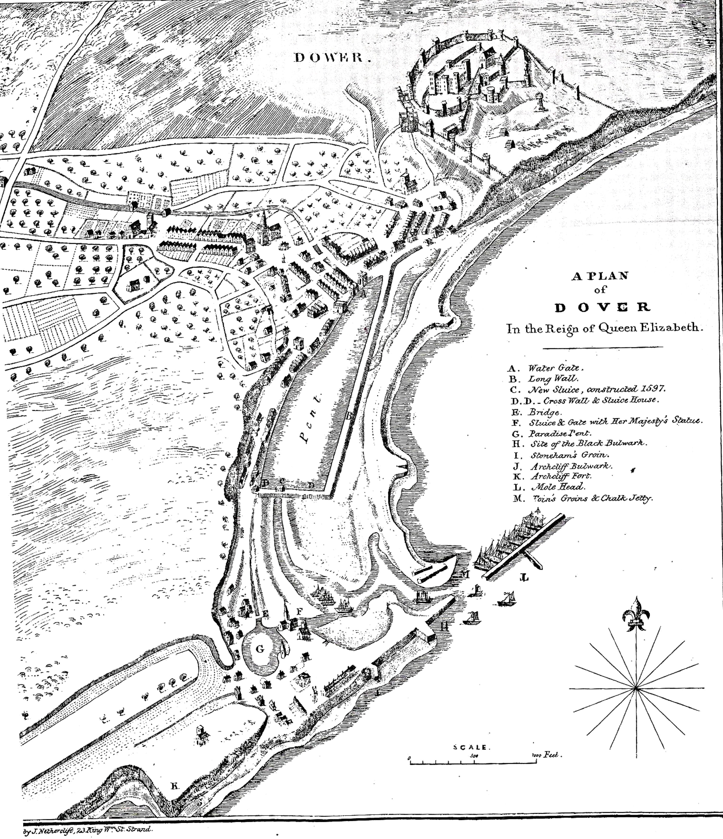
Harbour c1590 on the completion of Thomas Digges work drawn by Lieutenant Benjamin Worthington c1836. Dover Library
Digges came up with a new innovative design for a totally new harbour – and the Queen accepted it! The Eastward Drift had caused a lagoon to form across the Bay, which at its east end was fed by the Westbrook of the Dour and at the west open to the sea close to Paradise Pent. Digges utilised these physical changes enclosing the lagoon, which he named the Great Standing Water or Great Paradise Pent. A floodgate and sluice were inserted in the embankment at the sea end, which enabled the Great Paradise Pent to empty into Paradise Pent and clear the shingle blocking the harbour gates. To protect the town from flooding from the sea, another stronger sea wall, called the New Wyke, was built. Work on the new harbour began on 13 May 1583. It was finished about 1586, roughly the same time as the New Wyke was completed. This new harbour, costing £7,495 became the foundation of the Western Docks!
The problem of the harbour entrance silting up continued, this effectively narrowing the egress of the River Dour into the sea. In 1718, Cheeseman’s Head, a jetty south-west of the harbour mouth was built in order to try to deal with this problem. Nine years later (1727), a gate was inserted between the Great Paradise and the outer harbour of what had been the Paradise Pent in order to try and clear the blockage by holding back the Dour water in the Great Paradise and then releasing it in a whoosh at low tide. Nonetheless, by the time of the Napoleonic Wars (1792-1815), the Eastward Drift had rendered the harbour useless except at high tide and then, because the lower reaches of the Dour are tidal, high tides had the potential to cause flooding! By this time, most ships anchored in the bay, unloading onto rowing boats while flooding remained a problem in the town. Typically, on 14 August 1795, a violent storm hit the town and a torrent of water gushed down from the hills causing flooding, During this storm a cart belonging to a Mr Coleman, of the Priory, and carrying a load of dung was struck by lightning. The four horses pulling the cart were killed and Andrew Graves (1771-1794) of Whitfield, the waggoner, was swept down the valley into the Dour and drowned.

Dover Harbour Commission – James I (1603-1625) Royal Charter of 1606. DHB Website
King James I (1603-1625) set up the Dover Harbour Commission by Royal Charter in 1606 placing the Lord Warden and his Commission, now Board, in charge of running the harbour. One of the Rights in the Charter was that all reclaimed land up to the cliffs from Archcliffe in the west to the Boundary Groyne at the base of Castle cliff, belonged to the Commission. In 1800, the Harbour authorities asked Parliament if they could sell what was by this time the silted up Paradise Pent for building. Subsequently the Pier District developed to the west of the harbour and became inhabited by ship owners, shipbuilders, merchants, mariners and associated workers. It became a lucrative source of revenue for the Commission but flooding caused by the problems of tides, heavy weather and a blocked harbour entrance continued. The Pier District was particularly hard hit.
Along the banks of the River Dour a series of flood plains evolved but during the course of the 19th century building and industrial development took priority and often only a few feet above the mean level of the Dour. Then, to meet the desperate need for a Harbour of Refuge on the South East coast of Britain at the same time as a need for a harbour for national defence, the government decided to build an Admiralty harbour. The first phase was the Admiralty Pier that was began in November 1847 and eventually completed in 1875. It was not until 1895 that the final stage of the Admiralty Harbour, which encloses the Bay, was started and this was officially opened on Friday 15 October 1909.

Dour, in full flood, Dieu Stone Lane showing proximity of buildings. LS 2014
From when the foundations of the Admiralty Pier were laid, flooding caused by tides, as explained above, was exacerbated. Added to this there was the industrialisation, along the Dour, plus the large-scale house building and road laying programmes in the second half of the nineteenth century. The result of which turned the flooding problem into a regular crisis. In 1863, while what became Maison Dieu Road was being laid it was recommended that the surface should be raised 3 feet (1metre) above the Dour’s mean level. The Corporation decided that this was too expensive, so flooding of the road became a regular problem. Some thirty years later, the Corporation purchased the riparian rights to Stembrook Mill, further down the Dour, and lowered the base of the river by about 2 feet (0.6metres) from there to St James Lane. This initially solved the problem, but the continual development and the use of concrete or other impervious materials resulted in yet more flooding. In desperation, in 1905, the Corporation promoted a Bill in parliament to improve the drainage on Maison Dieu Road along with Folkestone Road. However, the problem of flooding has not gone away, for as the twentieth century progressed, the increase in population of these areas plus changes in household demands, have further increased the risks.
In December 1872, following heavy rainfall, the Dour overflowed its banks from Temple Ewell to Kearsney Abbey and from the Drellingore, in the Alkham Valley, to where the tributary joined the main river in Kearsney Abbey. Severe flooding from there to the sea put much of the town underwater. The guns at the Castle were unlimbered and removed as the cliff underneath was crumbling. Landslides were being experienced on the Western Heights and a 12foot crack was found in the tunnel of the London, Chatham and Dover Railway between the Priory and Harbour Stations. Water was also seeping through the walls of the South Eastern Railway’s Abbots Cliff tunnel.
Within a month, on 5 January 1873, following the classic combination of wind, weather and tide, the Pier District around the harbour, was severely flooded. This heavily populated area was not only under a combination of sea and fresh water but additionally raw sewage from the outfalls that discharged into the sea nearby. A destructive thunderstorm passed over Kent on 7 August 1876. Then on Sunday 14 November that year, there was an extraordinary high tide and a greater part of the Pier District was again flooded while a great deal of damage was done to the Seafront.

The laying of the track to the new Marine Station c1913-1914, Dover Museum.
Following nearly half a century of regular flooding, in 1899 a particularly nasty flood again hit the town and the Pier District was again under water and raw sewerage. To create a secondary sea defence, the Dover Corporation proposed to buy land from DHB. As the land statutory was under the terms of the 1606 Charter, this they were unable to do. However, at the time the Admiralty Harbour was being built, which it was believed would stop the tidal effect of Dover’s flood problem. Government sanction was secured to condemn and demolish much of the Pier District, with a population of over 1,000, and a new Viaduct providing road access to what became the new Marine Station was then built.
Dovorian, Arthur Finnis Adams, known as Budge (1909-2000), writing of his childhood in the early part of the 20th century, spoke of the ancient Dolphin Lane, which survived until 2018. On the lane was the then Phoenix brewery and Budge tells us, in an article, published in the Dover Society magazine of May 1991, that in heavy weather and spring tides’, flooding was regular. Hence sandbags were stored in the yard of the brewery in readiness such that it made it difficult to enter the premises! Yet, when the Admiralty Harbour opened it was expected that the tidal aspect of flooding would go away and, indeed, DHB are still quick to make this point.

Flood level plaque, St James’s Lane 7 May 1937 and taken by D. J Edward in September 1953. Dover Library
Further, on 7 May 1937, five days before the Coronation of George VI (1936-1952), abnormal rainfall flooded Maison Dieu Road. On the night of 20 May, during high tide, there was a thunderstorm that lasted two hours and the Dolphin Lane / St James Lane area was under such deep water that a mark was affixed to the wall of the Phoenix brewery. This happened again on 10 June and finally on St Swithen’s Day (15 July) that year, the floods extended from Maison Dieu Road to Townwall Street.
On 20 July 1937, the town’s Borough Engineer, William E Boulton Smith (1883-1975), presented a report to Dover Borough Council in Committee. In this, he stated that flooding occurred when heavy rains coincided with spring tides and that extensive and immediate steps were necessary to improve the surface water drainage system of Dover. He emphasised that the continual increasing number of roads impervious to water exacerbated the problem. His recommendations amounted to a cost approaching £400,000 and although work was initiated, due to the threat of War, it ceased following other calls on the town’s budget.
Following World War II (1939-1945), the frequency of floods in Dover increased due to new housing and industrial development, both of which centred on the Dour Valley. In July 1957, severe flooding occurred following heavy rain and a high tide restricting the discharge of the River Dour. In 1961, the Dover Home Guard (1944) Rifle Club based in the Trevanion Caves, close to the junction of Townwall Street and Woolcomber Street, ceased to exist due to continued flooding of its range. As usual the Maison Dieu Road area was vulnerable to flooding but so were most of the areas along Dover’s arterial roads such as the A2 and A20.
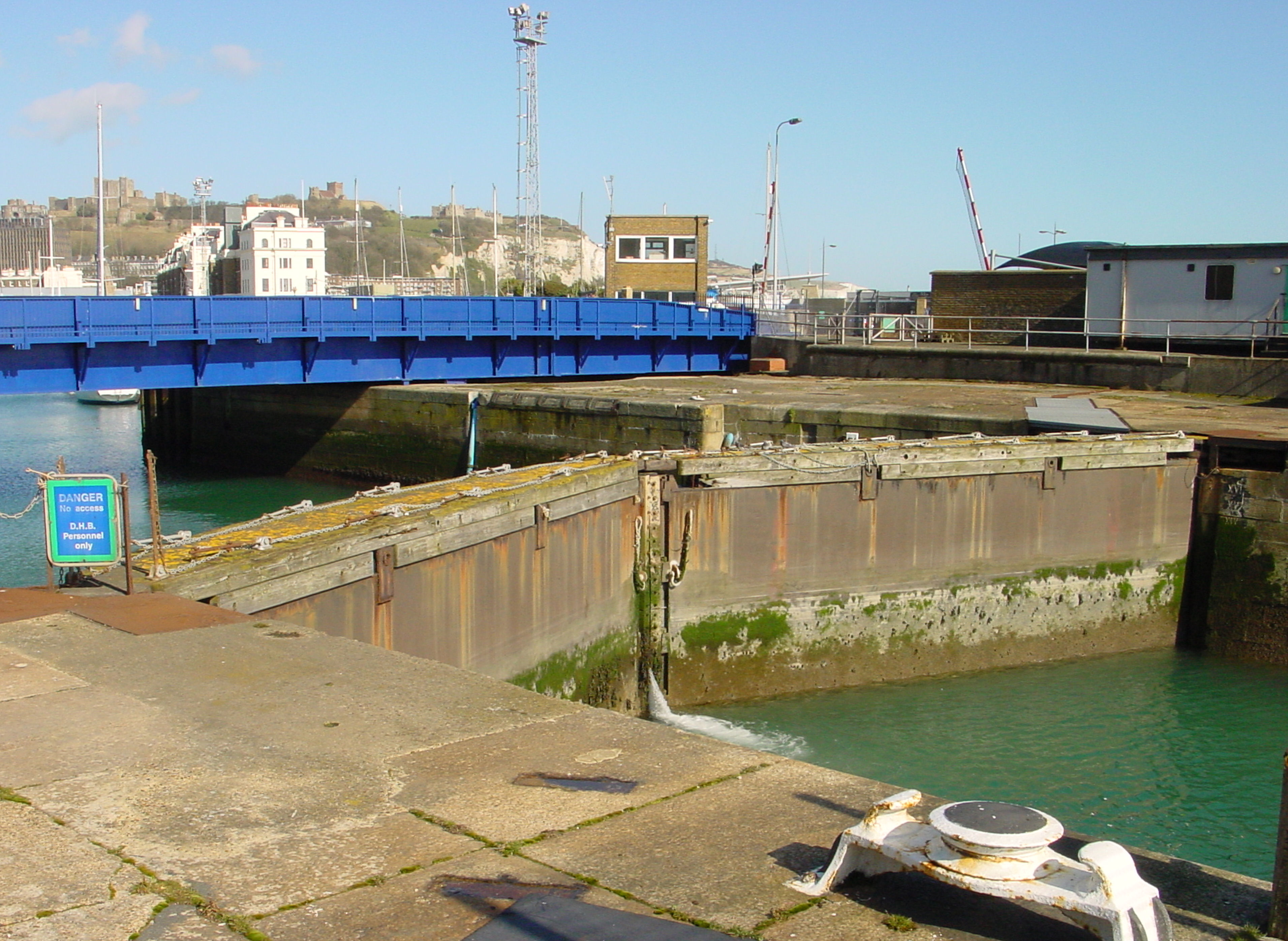
Wellington Dock mitre lockgates, which retain water within the dock when sea levels are low but cannot prevent water flowing in when sea levels are high. Alan Sencicle 2009
In September 1957, Boulton Smith’s successor as Dover’s Borough Engineer 1951-1972, David Richard Bevan (1912-2006), produced another report. He made similar observations as his predecessor but increased the number of recommendations to include those dealing with flooding caused by the classic combination of wind, weather and tide restricting the discharge from the River Dour into the sea. The Council were recommended to build a new wider bridge over the Dour at Flying Horse Lane and also a new surface water sewer to drain the area to the north of Market Square. Plus the division of the main sewer that crossed the Dour in a culvert under New Bridge. For the first time from the Corporation, there were recommendations to DHB! Bevan recognised, amongst other structural shortcomings at Dover’s harbour, the Wellington Dock gates particularly exacerbated Dover’s vulnerability to flooding as they were/are mitre lockgates, which can retain water within the dock when sea levels are low but cannot prevent water flowing in when sea levels are high.
The Bevan Report was adopted by the Council, and between 1957 and 1961 improvements were made along Barton Road, Granville Street and London Road from what is now Coombe Valley Road to Buckland Bridge. Then in March 1959, the Council approved a £7000 scheme for laying new sewers in a part of the Maison Dieu Road area that was particularly prone to flooding. However, DHB rejected the Bevan Report, implying that the town’s flooding problems were not theirs. Adding that in 1948, Head Wrightson and Co, engineers and iron founders, of Thornaby-on-Tees and Teesdale Ironworks, Stockton-on-Tees, had replaced the old Wellington Docks gates, which had been in situ for 75 years, with gates that cost £35,000, so DHB had no intention of replacing them.
The River Dour alongside Lower Road, Temple Ewell. Alan Sencicle
In 1972, the Reorganisation of Local Government Act was given Royal Assent and came into force on 1 April 1974 giving birth to Dover District Council (DDC). This was an amalgamation of four south-east Kent councils one of which was Dover Borough Council. DDC, in 1978, drew up plans to deal with emergencies such as flooding. The previous couple of years had seen a rise in the level of the Dour that had caused flooding in Temple Ewell. The blame was put on the National Coal Board who, apparently, had been sinking boreholes in the Lydden area in order to search for coal reserves and pumping the resultant water into the source of the Dour nearby!
Albeit, another source of potential flooding has developed since the early 1960s and this is getting worse. From that time, there has been an increase in the emphasis on human hygiene, the introduction of automatic washing machines and more recently dishwashers together with a rise in the number of self contained flats and extensive building on open spaces. These have all made a significant contribution to the increase of household water through Dover’s sewerage system at the same time as a significant reduction in the number of areas providing natural drainage. In order to help deal with this in 1994, the Victorian sewage works on Elizabeth Street, in the former Pier District, was upgraded and a 1.5metre diameter concrete pipe replaced the original outfall. At the same time a large underground sewerage farm was built at Broomfield Bank, Farthingloe, which opened in 1999.
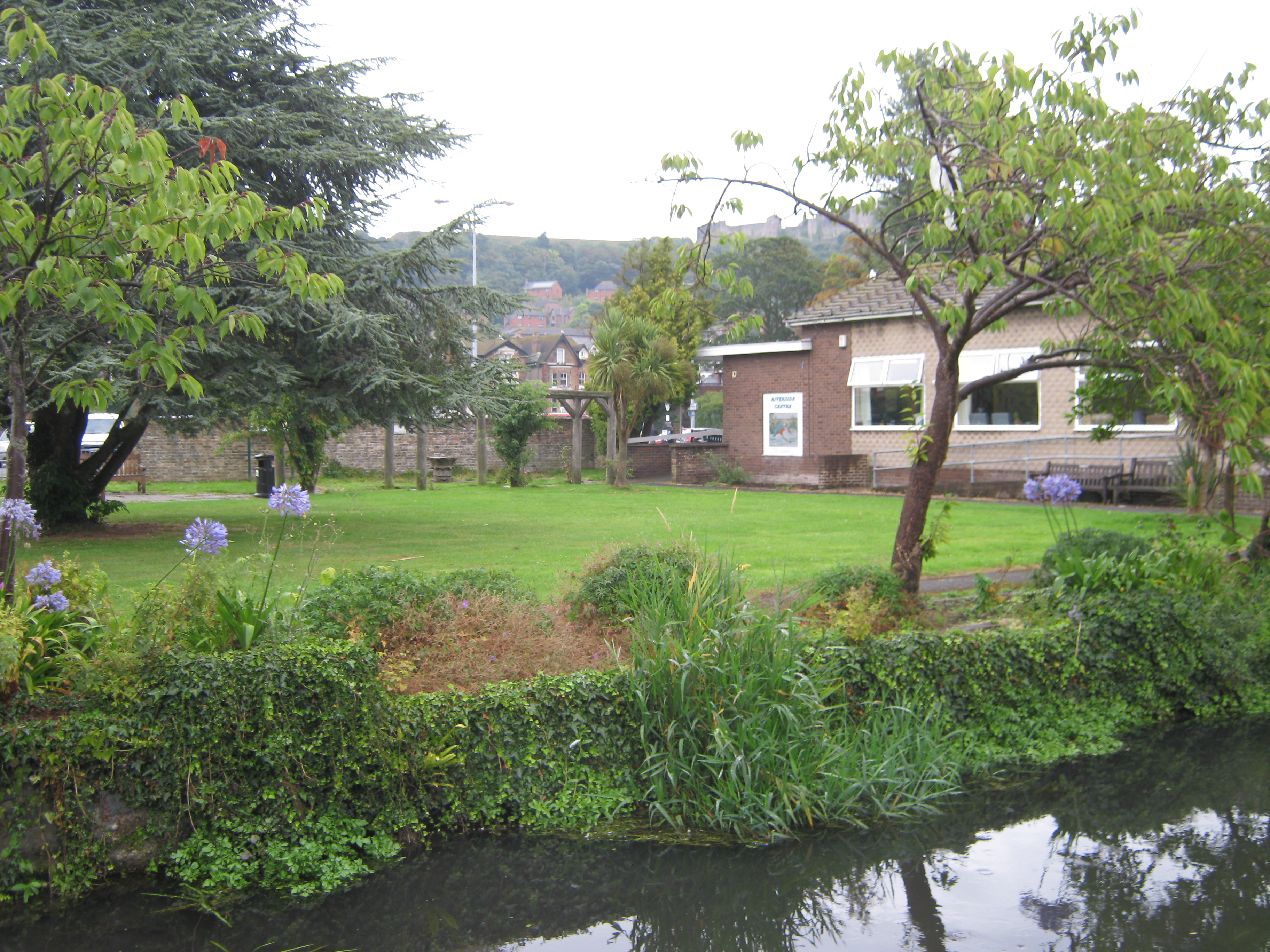
The specially built Riverside Centre to combat flooding, on the known flood plain, next to the River Dour.
Half a century after the Bevan report in 2008, a Dover Community Hospital, in line with the then government recommendations to include ‘step-up and step-down inpatient beds’, received the go-ahead. DDC decided to locate the new hospital on the former Brook House site, near to the Riverside Centre, in Maison Dieu Road and incorporating the Environmental Agency special anti-flood measures. However, a local pressure group, who were against a Community Hospital, objected to the scheme citing that the site was a recognised flood plain and rubbishing the key Environmental Agency report.
Thus, Dover’s new hospital project was downgraded and built on the car park of the former Buckland Hospital, on Coombe Valley Road. Ironically, this required the demolition of the unique underground Wartime Casualty Hospital complex specially designed to withstand heavy bombardment. From 1939 to 1943, what had been Buckland Workhouse was converted into a Casualty Hospital for wounded service men. The unique complex was in a deep reinforced concrete bunker, within which was the operating theatre made famous by Dr Gertrude Toland (1901-1985). She operated, with a team of doctors and nurses, during those dark War years, regardless of the bombing and shelling going on above, thus saving many hundreds of lives.

Flood prevention control box, Maison Dieu Road, installed by Southern Water Limited. The flood prevention pumps are nearby underground.
As for the proposal for a Community Hospital site on Maison Dieu Road, the Environmental Agency agent discussing his report told this author that although the site was vulnerable to flooding, that could be dealt with. A combination of factors caused the flooding, notably heavy rain and a high tide restricting the discharge of the River Dour into the sea, plus impervious road and car parking surfaces. Specialist building measures, similar to those used for the adjacent Riverside Centre had been intended for the proposed Community Hospital. However, he went on to say that a significant part of the problem lay with DHB, the River Dour provides the water for the Wellington Dock but the gates at times of high tides and heavy rain restrict the flow of that water into the sea.
Not long after, flood prevention kiosks and vents to reduce the flooding problem were built by Southern Water Limited. These are in Maison Dieu Road, Brookfield Place and at the Buckland Mill proposed housing development on Crabble Hill. Nonetheless, flooding continues, for instance, in July 2012, a combination of high tide and two hours heavy rain caused serious flooding to shops and homes along the Dour valley.
3. Western Docks Modern History
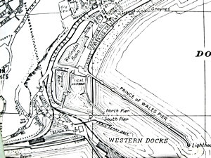
Map of Dover Western Docks circa 1970 showing Wellington Dock, Granville Dock the Tidal Basin, base of Admiralty Pier, North and South Pier, Prince of Wales Pier and the railway lines to Marine Station.
The Western Docks complex is made up of Wellington Dock, Granville Dock, the Tidal Basin, Admiralty Pier on which is the former Marine Station now the Cruise terminal and the Prince of Wales Pier. The Western Docks complex is made up of Wellington Dock, Granville Dock, the Tidal Basin, Admiralty Pier on which is the former Marine Station now the Cruise terminal and the Prince of Wales Pier. The final leg of the River Dour’s journey to the sea is through culverts under New Bridge and Cambridge Terrace and into Wellington Dock. The culverts were constructed in the 1840s and as the lower reaches of the Dour are tidal the floor of the river was lowered before entering the culverts. In 1874, Union Street, between Snargate Street and the Esplanade on the Seafront was widened and the Wellington Dock bridge on Union Street and between Wellington Dock and the Tidal Basin, was erected.
Following World War II, Dover Corporation commissioned Town Planner, Professor Patrick Abercrombie (1879-1957), to drawn up a plan for Dover’s future development. Among the many recommendations was the designation of the Eastern Dockyard for industrial purposes and major changes. The Dover Town Clerk moved into New Bridge House in 1949, which according to the 1606 DHB Constitution belonged to DHB, but he claimed it for Dover Corporation! At the time not only was the harbour in a poor state of repair but DHB were desperately short of money due to lack of revenue during the War. Besides replacing the Wellington Dock gates in 1948, amongst other projects, work started on repairing war damaged Ballast Quay, on the other side of Wellington Dock, opposite the present day Bradelei Wharf shopping complex. Ballast Quay was re-designed adding nearly 50-feet (15.25 metres) to its length and the gravel dredging industry moved in with their ships that later included South Coast Shipping’s Sand Dart (1957).

Front Door of Dover Harbour Board headquarters on Waterloo Crescent with the DHB crest over the door. Alan Sencicle 2009
In 1950 DHB moved from Council House Street in the Pier District to new Headquarters in the western block of Waterloo Crescent on the Seafront, where they are today. They immediately installed the Harbour Board Crest over their new front door and re-exerted their right of ownership of ALL reclaimed land from Archcliffe in the west to the Boundary Groyne at the base of Castle cliff to the east, as sanctioned by the 1606 Charter. Further, they laid claim to the Eastern Dockyard as it was part of Dover Harbour!
Dover Corporation were furious for in November 1949, against their strenuous opposition, DHB had promoted a Parliamentary Bill to create a specialised Car Ferry terminal at the Eastern Dockyard. Permission was given in February 1951 and it was estimated that the facility would cost £500,000. The Dockyard was designated for Dover’s first drive-on drive-off ferry terminal and renamed Eastern Docks! The first stage opened in 1953 with two designed ferry berths, each with single link spans, accommodating two ships at any one time. At that time the Admiralty Pier was still Dover’s main ferry terminal and had eight berths including the Train-Ferry dock.
October 1956 saw the 350th anniversary of the Dover Harbour Board which they celebrated in style. This was not surprising as the drive-on, drive-off facilities offered at Eastern Docks was proving successful in creating a dramatic increase in car and coach traffic through the port. The Lord Warden, Sir Winston Churchill (1874-1965), wrote a letter of anniversary congratulations adding, ‘Your famous port has served the country well in peace and war, and I am happy to recall its long association with the Office of Lord Warden of the Cinque Ports.’
All augured well for DHB but the poor rail and road infrastructure, through the county of Kent to Dover, was failing to meet the increase in demand. Hence, Kent County Council (KCC) put pressure on the government to accept the notion that no freight carrying rail routes were to pass through Kent to the Channel Ports. Further, all container and passenger Continental road traffic was to use Channel crossings elsewhere rather than to pass through Kent. The main crux of their argument, which was spelt out in County and government documents and parliamentary speeches, was that Kent was the Garden of England and that the East Kent coast was primarily a tourist destination.

Charles II memorial and Walk at the time it opened in 1960. DHB
DHB appeared to endorse the tourism objective, particularly by commemorating the tertiary centenary of the 1660 Restoration by building the Charles II Walk on the Seafront. This was designed to pass the actual spot where Charles II (1649-1651 and 1660-1685) landed on 25 May 1660 and was opened to great razzmatazz. The King Charles Walk went from the Esplanade under the Prince of Wales Pier to the North Pier, which opened up, to both the townsfolk and tourists, a little known part of the harbour. It was a great success.
The KCC argument was taken on board by parliament. On 27 March 1963, the British Railways Board published their two part document, The Reshaping of British Railways, better known as the Beeching Report after the physicist and engineer, Dr Richard Beeching (1913-1985) the Chairman. Part of the recommendations of the Beeching Report was to encourage the growth of non-Kent ports for cross Channel traffic so diverting traffic away from Kent. The result was a piecemeal updating of Kent’s transport system.
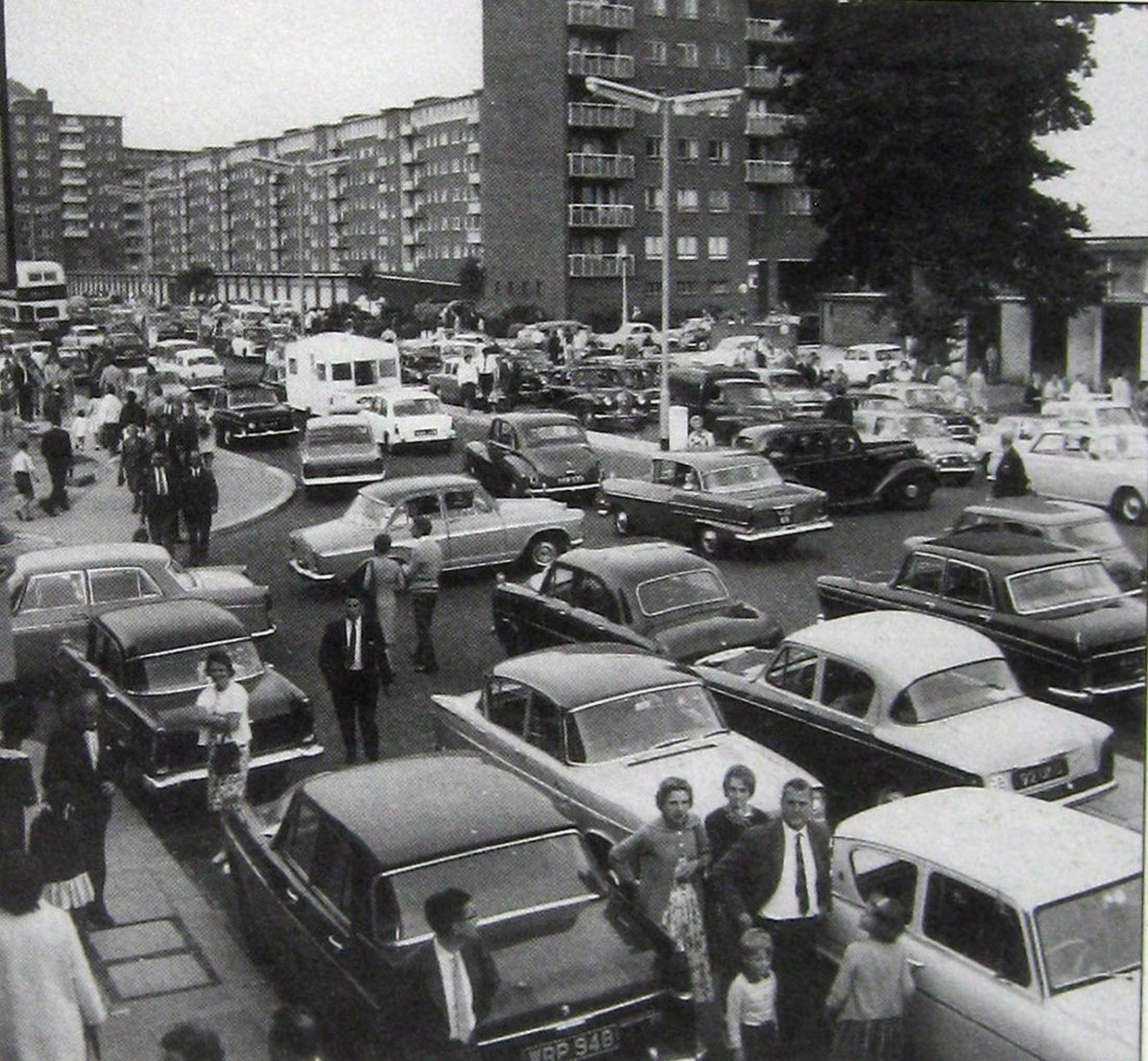
Townwall Street, the main road to Eastern Docks through Dover, gridlocked – 1965. Ray Warner.
DHB were not happy with the Report’s conclusions. Nonetheless, as the shortest sea crossing to the Continent plus reduced rail services nationally, road traffic continued to increase with the related increase in car ownership. DHB obliged by reclaiming land at the Eastern Docks seawards of the original customs hall and terminal buildings to build another berth. This allowed two lanes of vehicles to be loaded or unloaded simultaneously and opened in 1965. That year also saw the introduction of the roll-on, roll-off (Ro-Ro) service for freight at Dover. Before then lorries were loaded at the factory, the goods were off-loaded into the hold of a ship for the Channel crossing, and the process was repeated in reverse on disembarkation. Ro-Ro increased lorry traffic and together with the still increasing holidaymaker traffic, the effect on roads in the County was an increase in congestion and Dover was frequently grid locked.
To meet the increasing road traffic wanting to cross the Channel from Dover, DHB looked at different ways to create more ferry berths and decided to move the Hovercraft service to the Western Docks. The site they chose was on 15acres of foreshore next to the Prince of Wales Pier, between the Clock Tower and the North Pier. Much of the Charles II Walk disappeared and part of the Grade II listed Prince of Wales Pier, closest to the shore, was moved eastwards and the open iron work filled in. This development had a negative effect on the tidal flows within the harbour. A public outcry followed and the Minister for the Department of Environment, Anthony Crosland (1918-1977), called in the Planning Application for examination. It was given retrospective planning permission. Besides the new Hoverport, which opened in June 1978 and cost £12million, this created a lack of trust between the town and DHB, which still remains.
Four years earlier, on 1 April 1974, the Reorganisation of Local Government Act (1972) had come into force creating Dover District Council – DDC (see above), and the fledging DDC were face with a mountain of issues. Due to the political weakness of the makeup of Dover’s representative Councillors, the growth of road traffic through Dover was not high on DDC’s agenda. At the time, the A20, in the east of the County was little more than a winding country lane and the A2, the main London-Dover road, was an upgraded coach road. It had two lanes, one in each direction that traversed steep hills and ancient rural villages. By this time the amount of freight traffic was on a par with passenger car traffic and growing.
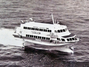
Prinses Stephanie – Jetfoil. Belgium Marine and Sealink. Dover Transport Museum
The European Community Act of 1972 was granted Royal Assent on 17 October that year and the United Kingdom became an official member of the European Economic Community (EEC) on 1 January 1973. Brussels was considered the de facto capital of the EEC and in consequence there was a demand for a frequent and fast public transport service between London and Brussels. The National Railway Company of Belgium (NRCB) operated Ostend’s 16 platform railway station from where trains went as far as Cologne, Berlin, Vienna, Copenhagen and Moscow but in particular, Brussels.
The Belgian state-owned ferry service, Regie voor Maritiem Transport (RMT), operated the Ostend-Dover route under the name Oostende Lines. Together with Sealink UK Ferry Company, they responded by inaugurating a fast Jetfoil passenger service between the Admiralty Pier and Ostend in May 1981. A special basin and berthing pontoon, costing £1.3million was built, with DHB, Sealink and RMT sharing the cost. Princesse Clementine and Prinses Stephanie, two Boeing Jetfoils, arrived in July and made the crossing in 100 minutes against the 3hours 45 minutes taken by ferries.

Jetfoil Basin, left Marine Station – at the time renamed Dover Western Docks – right the train ferry dock and behind, Southern House. Dover Museum
In order to provide a protective breakwater across the jetfoil basin, a sheet pile wall, 66 metres in length, 10 metres wide and 16 metres above the seabed was constructed. The steel piling came from British Steel’s Middlesborough Plant and 10-tonne stone blocks were laid, which were made on Shakespeare Beach, and used to form a wave-absorbing slope. The Jetfoil service saw a throughput of over 100,000 passengers in its first year of operation. Between 1985 and 1990, RMT operated in partnership with Townsend Thoresen and the jetfoils livery was changed accordingly. In 1994 the Jetfoil base was moved to Ramsgate where the service only survived a further three years.
At that time, One of the main cross Channel ferry operators was the nationalised British rail subsidiary, Sealink. The other was the privately owned Townsend Thoresen cross Channel ferry company that was formed in 1968 by the amalgamation of Townsend Car Ferries – founded in 1928 and Thoresen Car Ferries – founded in 1964. Following a take-over, Townsend Thoresen became the marketing name for European Ferries and eventually they operated from Dover as Townsend Thorensen European Ferries. In the meantime, in 1967, P&O Ferries, using the brand name Normandy Ferries, started operating between Dover and Boulogne. The Belgium state-owned ferry service Regie voor Maritiem Transport (RMT), as noted previously, operated the Ostend-Dover service.

Reine Astrid – Belgium Regie voor Maritiem Transport, Oostend Line, berthed alongside Admiralty Pier with other Belgium ships. Dover Harbour Board.
The Belgium ferry service out of Western Docks to Ostend and back was very popular and to meet the demand RMT brought larger ships on line and enlarged their existing cross-Channel Ferries. To accommodate them, in 1982, DHB fitted a new fendering system at Number 3 berth on Admiralty Pier at a cost of £109,000 then undertook further work, which eventually came to £½million. At the time RMT, who operated the Ostend service, had formed a consortium with the British state-owned shipping service, Sealink. However, following the privatisation of Sealink in 1984, the relationship between the two companies broke down and between 1985 and 1990, RMT operated in partnership with Townsend Thorensen European Ferries. From 1991 the RMT ran its Oostend Line independently then in 1993, they went into partnership with Sally Line ferries that operated passenger and freight crossings between Ramsgate and Dunkerque West. After 147 years in Dover, RMT transferred their operations out of the port to Ramsgate but Sally Line ceased operating in 1997 and financial losses led to RMT’s eventual closure.
In 1984 Sea Containers Ltd, under its American founder James Sherwood, bought British Rail’s Sealink UK Ferry Company and renamed it Sealink British Ferries. The company leased Western Docks and said that they planned to redevelop and modernise it. The refurbishment included the upgrading of the ro-ro ferry berth, a new ferry berth and a new train ferry berth. In November 1984 work started on the reconstruction of the Sealink British Ferries ro-ro berth. Costing £450,000 this was completed in February 1985. An agreement between Sealink British Ferries, British Rail and the French SNCF (Société Nationale des Chemins de fer Français) Railways – who owned SeaFrance Ferries – to build the new Train-Ferry berth. This had previously been confirmed before Sherwood had bought Sealink and so construction began. The civil engineering contractors were W. A. Dawson Ltd. of Sundon Park, Luton and the project cost £8.9million.
The first train-ferry service to operate from Dover was in 1936, with the sea crossing going to Dunkerque. The final passenger service was on 27 September 1985 on the multi-purpose Sealink ferry St Eloi and the dock closed on 8 May 1987. The site was used as a depot for importing aggregates for road making. The consortium’s new berth was designed for ships of 23.0-metre beam and as part of the scheme new rail sidings costing £0.35million were laid by British Rail. A loading bridge and a machinery computer controlled link span was added, to meet the different states of the tides and was built by Cleveland Bridge and Engineering Co, Darlington, at a cost of £34.6million. The SeaFrance ship Nord Pas de Calais, built in 1987, was designated to use the berth and designed to take ro-ro container-lorries on the upper deck and trains on the lower deck. However, the Great Storm of 15/16 October 1987 wreaked havoc on the construction time but the service did eventually start operating between Dover and Dunkerque only to end on 22 December 1995 due to the opening of the Channel Tunnel. Following the closure of the new train ferry berth, the specially built bridge that connected with the ships remained on the Admiralty Pier for some time before being cut up and sold for its recyclable metal value.

Nord Pas de Calais with MyFerryLink livery 2012-2016 based at Eastern Docks. Alan Sencicle
In 1989, the Swedish ferry company Stena acquired 8% of Sea Containers and that company no longer leased Western Docks. Following a hostile take-over bid in 1991, Stena Line bought Sealink British Ferries and the Dover operation was rebranded first Sealink Stena Line, then Stena Sealink Line and finally Stena Line! Following the merger with P&O European Ferries in late 1997, the new company operated as P&O Stena until it was bought out by P&O Ferries in 2002. In 1996, the Nord Pas de Calais was renamed SeaFrance Nord Pas de Calais, transferred to the Dover and Calais crossing and from the end of that year she only carried freight. SeaFrance ceased operations in November 2011, when the ferry was bought by Eurotunnel, who dropped the prefix Sealink. Following a refit, in November 2012 the Nord Pas de Calais joined the Eurotunnel owned ferry company MyFerryLink but following the demise of the latter in 2016, she was renamed and chartered to run between Spain and Morocco.
The Channel Tunnel (French: Le tunnel sous la Manche), is a 50.45-kilometre (31.35 mile) rail tunnel from Folkestone to Coquelles, near Calais, France, was ratified by the Treaty of Canterbury. This was signed at Canterbury Cathedral on 12 February 1986 by the British Foreign Secretary (1983-1989), Sir Geoffrey Howe (1926-2015) and Roland Dumas, the French Minister of Foreign Affairs (1984-1986). The Treaty stipulated that the Channel Tunnel was strictly to be privately financed and the project started in 1988. It was finished in 1994 and cost £4.65 billion to build but this increased to £25 billion to provide the infrastructure such as high-speed railway lines and motorways. The infrastructure, according to a Eurotunnel Report of 2003, was financially backed directly and indirectly by the governments involved. Eurotunnel was founded 1986 and manages and operates the Channel Tunnel and in November 2017, Groupe Eurotunnel was rebranded Getlink. The Channel Tunnel was officially opened by Queen Elizabeth II and the French President François Mitterrand (1916-1996) on 6 May 1994. It provides Eurostar high-speed rail services between London and Paris and between London and Brussels, as well as car, coach and freight transport carried on a shuttle service between Folkestone and Coquelles.
Flexilink set up by DHB, Chambers of Commerce, Ferry & Freight operators, in opposition to the Channel Tunnel. 1986
From when the Tunnel project became a possibility DHB joined other ports, ferry, hovercraft and jetfoil operators as well as freight companies and Chambers of Commerce, and founded Flexilink to fight the Tunnel project. This enabled them to put pressure on the government so with the building of the M20, to provide a motorway connection between London and the Tunnel, the government agreed to upgrade the A20 as a concession to Dover. A short list of several routes was to be looked at a Public Inquiry in spring 1988, following which the democratically determined preferred route would be announced. DHB’s preferred route was the one we see today, which goes over the cliffs by Aycliffe to Western Docks, joins Townwall Street, then Marine Parade at East Cliff to Eastern Docks. Due to the continual heavy traffic going to and from Eastern Docks and only one underpass for walkers and cyclists, the road effectively cuts off the town of Dover from its Seafront. On 18 March 1987, before the Public Inquiry, this route was endorsed by the then DDC Chief Executive John Moir, in a statement he made to the House of Lords Select Committee (Hansard pp343-345). Following his retirement from DDC, Mr Moir joined the Board of DHB. Meanwhile, the M20 to Folkestone was completed in 1991 and the A20 section, costing £24million, was started in 1989 and completed in 1993. The Channel Tunnel opened to traffic in November 1994.
As the Channel Tunnel was being built, DHB and the Dover ferry operators slimmed down the work force. Directly and indirectly this caused 12% of the working population of the town to become unemployed. This reduction in staffing, it is thought by many Dovorians, to have ultimately led to tragedy. European Ferries marketed their Dover-Continental routes under the name Townsend Thorensen European Ferries. In 1986 P&O Ferries purchased a 50.01% interest in European Financial Holdings Ltd, which held 20.8% of shares in European Ferries and placed its Chairman (1983-2005), Sir Jeffrey Maurice Sterling on the Board. Staffing cuts were instigated and at the end of February 1987 P&O Ferries completed a successful £448million takeover of European Ferries. This included Townsend Thorensen European Ferries but retained the name for the Dover crossing. One of their three larger ships, the Herald of Free Enterprise, launched in 1980 and at just under 8,000 tons was licensed to carry 1,300 passengers and 350 cars. Like all larger ships, she was based at Eastern Docks and normally operated on the Dover-Calais crossing. However, she was temporarily transferred to the Zeebrugge crossing to replace another vessel away for annual re-fit.

The Herald of Free Enterprise Disaster 30th Anniversary Memorial Service held at St Mary’s Church 6 March 2017.
On the evening of 6 March 1987, the Herald of Free Enterprise left the Belgium port with her bow doors open. This caused her to take on water onto the lower car deck and she capsized onto a sandbank. The accident caused the deaths of 155 passengers and 38 crew, many of the latter came from the Dover area. Long lasting tributes can be seen in St Mary’s Church and other churches in the area as well as on special dedicated public seats on the Seafront. At Herald Wood alongside the A2 at Whitfield, there are planted the same number of trees as those who lost their lives. The disaster also effectively destroyed the soul of Dover, from which the town never fully recovered. This was exacerbated the following year with a bitter dispute between P&O Ferries and their workers.
Following the accident, P&O quickly dropped Townsend Thorensen European Ferries from their Dover based ships and replaced it with their own P&O livery. As mentioned above, in late 1997 P&O merged with Stena to form P&O Stena. The new company had gross assets of £410million, 14 ferries and 5,000 employees. Faced with the threat of the Channel Tunnel, the staffing cuts introduced the year before were intensified not only by cutting the workforce but forcing those that remained to agree to live on board at all times during their rostered working weeks. The number of ferries were reduced to six and they were all based at Eastern Docks leaving Western Docks without a regular cross Channel ferry service.
The total amount of traffic in 1988 crossing the Channel via Dover was 14,885,445 of which cars made up 82.75% and most were carried on ships berthed at Eastern Docks. The ferry companies, aiming at least to retain this throughput or even to increase it, introduced larger ferries that internally were designed to have the look of a cruise ship. This, it was believed, would attract more car carrying passengers when the Channel Tunnel opened. DHB also responded to the threat by expanding Eastern Docks and making them more user friendly. They also looked to help the hovercraft company, Hoverspeed, to expand. Following the move to the specially built Hoverpad on Western Docks Seafront in 1978, the two hovercraft, Princess Margaret and Princess Anne were lengthened to just over 56-metres and widened to nearly 28metres. They were 11.73metres high and when air cushions inflated, 14.17 metres high. The two modified craft were able to carry 424 passengers and 52 cars. In 1988, Hoverspeed had made a pre-tax profit of over £3million and James Sherwood’s Sea Containers Ltd bought the company but retained the name. They also decided to introduce catamarans or as Hoverspeed marketed them, SeaCats.

Hovercraft Princess Margaret passing through the Eastern Entrance in 1971. Alan Sencicle
The Seacat Western Dock Fast Ferry (catamaran) berth was constructed on the Prince of Wales Pier side of the Hoverpad. It consisted of a bank seat, portal dolphins, Linkspan bridge and side fendering system. The first vehicle-carrying catamaran, the Great Britain designed to carry 80 cars and 450 passengers visited Dover in November 1990. The following year, two Seacats started operations. Although quieter than the hovercraft, they were slower and many passengers found their unique motion uncomfortable. At the end of 1993, the Seacat base was moved to Folkestone with Sterling stressing that some would stay in Dover but that the hovercraft would remain the core of the operations. Shortly after, the two hovercraft were withdrawn but were reintroduced in 1995 following the relaunching of Hoverspeed. Two years later, in 1997, a Seacat service from Dover to Ostend was introduced.
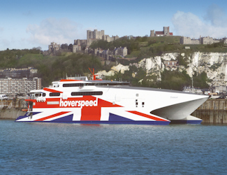
Hoverspeed’s Seacat Diamant. Dover Harbour Board
In 2000 the hovercraft were withdrawn from service and the renamed Fast Ferry (catamaran) berth was extended with a passenger access walkway with operating machinery installed. This was for the arrival of Hoverspeed’s Italian built vessel SuperSeacat One, the following year. The 100-metre long craft increased the company’s capacity by 80%, initially using number Four berth at Eastern Docks, in May 2004 SpeedFerries catamaran service started operating. Aiming to undercut the fare ferries charged, SpeedFerries caused Hoverspeed to also cut their prices. Because of the price war, by July 2005 Hoverspeed was in financial trouble and on 17 November 2005 the Seacat Diamant made the last crossing out of Dover.
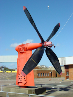
Hovercraft Propeller at the defunct Hoverport western end of Seafront. Alan Sencicle 2009
In January 2007 Speedferries moved their catamarans from Eastern Docks to the former Hovercraft Pad, one of which was SpeedOne. She was an Incat catamaran, launched in 1997, 86.62metres in length with a capacity to carry 900 passengers and 200 cars operating on the Dover-Boulogne route. In November 2008 SpeedFerries had a reported operating debt of approximately £1.2million and SpeedOne was impounded at Boulogne. Shortly after SpeedFerries went into administration and the Western Dock Fast Ferry (catamaran) berth was officially taken out of operation. Together, the hovercraft and catamaran services had survived for fifteen years after taking on both the Channel Tunnel and also cheap air flights. However, between 1993 and 2008 the number of passengers crossing the Channel via Dover had fallen by 24.78% and the number of tourist cars by 5.77%. All that was left when the Hoverport site was abandoned was deserted buildings, the Fast Ferry (catamaran) berth and a lone mounted hovercraft propeller.
Western Docks redevelopment plan 1993
Back in the early 1990s, when cross Channel ferries were getting bigger and had moved to Eastern Docks, DHB looked for alternative uses for Western Docks and they decided on a major waterfront development plan. The scheme was expected to cost £100million and included a yachting marina, blocks of luxury flats, a superstore, a 100-bedroom hotel and offices. The first phase was scheduled to start in 1994 and this was to be the superstore adjacent to Wellington Dock. The Grade II listed (Scheduled Ancient Monument) Dock was to be partly filled in to provide a car park for the superstore and to gain permission would take time, so work started on the proposed yachting marina in Granville Dock.
Used by freight vessels, they were moved to the Eastern Docks, while the gravel dredging industry was moved from Ballast Quay to what had been the Jetfoil Basin. About £1million was spent on modifications and work on the gates, sluices and quay faces of the Granville Dock. It was envisaged that when completed it would provide berths for 400 yachts but in the event, there was only space for 136 yachts. Although there were objections over the proposed partial filling in of the Wellington Dock, the main objection was from the Department of Environment (DoE). The objection was entirely unexpected and alarmed DHB. The DoE made it clear that part of the responsibility for Dover’s perpetual flood problem was due to the lay out of Western Docks and they objected to the proposed changes to Wellington Dock as they would grossly exacerbate Dover’s flood problem!

The former Marine station entrance, now cruise terminal 1. Dover Harbour Board
The scheme was abandoned but another facility in Western Docks was ripe for marine development and that was the Marine Railway Station at the base of Admiralty Pier. In 1992, the lease held by British Rail expired and Grade II Listing had been given that year. The station had a unique nationally related history, iconic stone work friezes and its elegance had assured its use in many films and TV plays. Designed by Sir Percy Crosland Tempest (1860-1924), the Chief Engineer of the London, Chatham and Dover Railway Company, within the building the station had six tracks, with platforms 3,4,5 and 6 around two islands. Access was from Lord Warden Square by a stair tower and a covered walkway and a pedestrian bridge with stairs going down to the platforms. The covered walkway and stair tower was divided internally to separate the station access from the Admiralty Pier walkway. When it was completed in 1914, Marine Station was estimated to have cost £250,000 and it was already considered of great architectural merit.

Marine Station, the Rod of Asclepius, the ancient Greek symbol of medicine in recognition of the role the station played during World War I. Alan Sencicle
On 4 August 1914, World War I (1914-1918) was declared and Marine Station was commandeered to send troops to the Western Front. The station remained one of the country’s major hubs for the transportation of troops to and from the Continent and from 2 January 1915, Dover was designated the main receiving port for the men wounded at the Front. During the War, 3,166 ambulance ships were berthed at Admiralty Pier and 7,515 special trains, conveying 1,215,886 patients left Marine Station to hospitals throughout the country. In honour of this role, the Rod of Asclepius, the ancient Greek symbol of medicine is depicted on the stone work friezes on the outside of the building. Marine Station returned to civilian use in January 1919 and a magnificent Railway Workers War Memorial was erected. On the morning of 11 November 1920, aboard the destroyer Verdun, the body of the Unknown Warrior arrived at Admiralty Pier and was taken by train, from the Marine Station, for burial in Westminster Abbey.
Golden Arrow at Platform 3 Marine Station c1950s – David Ryeland Collection
During the inter-war period, the Marine Station was Dover’s most popular railway station and it was from there that wealthy passengers boarded the famous Golden Arrow railway service. On 12 May 1940 in World War II, Marine Station was closed but in June 1941, it was opened for military traffic going to the Second Front following Germany’s invasion of Russia. The Station then played an important part in the movement of military personnel, armaments and latterly railway engines to the War devastated Continent. Following the War the Station returned to its former civilian use and it was at this time that filmmakers and later TV producers included the building in their productions. However, on 24 September 1994 the station officially closed and DHB had already made a plan for its future.
In 1990, Fred Olsen Cruise Line of Harwich had approached DHB with a view to Dover becoming one of their homeports. This was agreed and a scheme costing £10million to revamp the former Marine Station was put into operation. As a Grade 2 Listed building the railway tracks had to be retained along with the magnificent Railway Workers War Memorial. The tracks were covered by the car parking area and the Railway Workers War Memorial now plays an important part in Armistice annual celebrations on 11 November. In 1996, the former elegant railway station reopened as a smart cruise terminal, which proved such a success that three years later work started on Cruise Terminal 2. This is on the site of the original Train-Ferry dock and Dover Cruise Port is now the UK’s second busiest cruise port.

De Bradelei Wharf – built as shipbuilding shed and later became DHB workshops – at the side of Wellington Dock with anchors restored by Richard Mahony. Alan Sencicle
Complimenting the new cruise liner service, in the summer of 1996 DHB joined with factory shopping specialists, De Bradelei Mill, Chapel St, Belper, Derbyshire, to create an upmarket shopping outlet alongside Wellington Dock. They converted part of the DHB’s former shipbuilding sheds, which had been used in recent years as DHB workshops on Cambridge Road, into a 10unit-retail facility. This was named De Bradelei Wharf and the project proved popular not only with cruise line passengers but also with locals. The remainder of the buildings were converted and they too became part of theDe Bradelei Wharf shopping outlet. To provide a car park, the remaining dockside buildings, which included DHB Social Club, were demolished. The nearby former Cullin’s boatyard was converted into a popular restaurant and bistro and in De Bradelei Wharf and on Wellington Dockside can be seen some Dover maritime artefacts, restored by Richard Mahony.
By the millennium, Dover’s Western Docks was becoming a vibrant area, besides Cullin’s yard, other restaurants were also opening. Granville Dock was full of yachts and although DHB were only offering 35 marina berths in Wellington Dock in 1991 they promised more. By 2009, there was room for 157 yachts! There was also the popular Prince of Wales Pier, favoured for strolling, watching activities in the harbour and enjoying refreshments in the end of Pier, Lighthouse café. On Admiralty Pier the cruise terminal was busy and the walkway was particularly favoured by sea-anglers and those who enjoyed a bracing walk in the sea air. Regardless of the ferries, the harbour was popular for small craft with the annual regatta a particular crowd-pleaser. The beach remained popular, particularly in hot weather with special events on the Seafront well attended.
Baron Francis Arthur Cockfield of Dover (1916-2007), the Dovorian who was the architect behind the Single European Market.
In 1992, events across the Channel instigated by a Dovorian were, however, to make a negative impact. The UK joined the European Economic Community (EEC) on 1 January 1973 and in 1979 the Conservative Party were returned to power under Margaret Thatcher (1925-2013). Baron Francis Arthur Cockfield of Dover (1916-2007) was a staunch supporter whose war-widowed mother had returned to her parents for his birth. With her new born infant, she returned to her home on the Clarendon Estate. Not long after, she moved to Beaconsfield Avenue from where Cockfield attended a local school before winning a scholarship to Dover Boys’ County School, (now Dover Boys Grammar School). Proving to be very bright, Arthur went on to read law and economics at the London School of Economics. In 1982, Cockfield was appointed to the Thatcher Cabinet as President of the Board of Trade until it merged with the Department of Industry the following year. In September 1984, on Thatcher’s instigation, Euro-sceptic Cockfield joined the European Commission under pro-European Jacques Delors.
At the time Delors was planning to carry the Treaty of Rome, – signed on 25 March 1957 and effective from 1 January 1958 and the basis of the European Community (EC)- to its logical conclusion, that of a Single European Market (SEM). Delors knew that although Cockfield was against the SEM, he was known for his thoroughness and intellectual rigour and so Delors appointed Cockfield his Internal Market Commissioner. Cockfield lived up to Delors’ expectations and effectively became the architect of the SEM. In 1987, the EC members committed themselves to removing all remaining barriers and on 1 November 1992 the SEM came into force. This seeks to guarantee the free movement of goods, capital, services, and labour within the European Union and the number of goods carrying vehicles, going through the port of Dover started to increase at a greater rate.
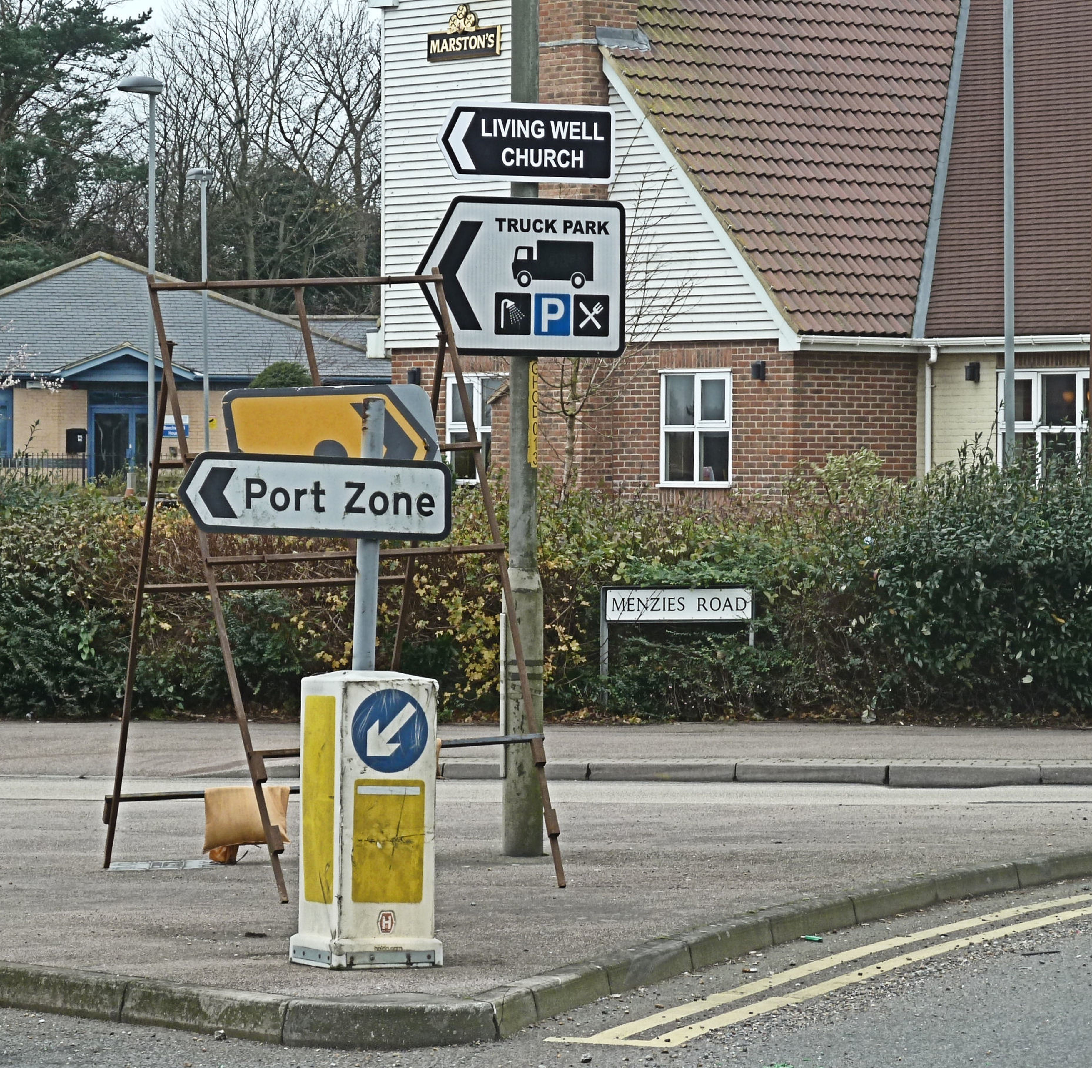
Port Zone and truck parking signs at the entrance of the Old Park estate. LS
In 1993, the first full year after the introduction of the SEM, 1,107,246 heavy goods vehicles passed through the port of Dover and by 1997 the figure had risen to 1,602,863, an increase of 44.76%. Parking space had been increased at Eastern Docks but congestion had become a major problem. At Whitfield the 225 acre former Old Park Army Barracks had been put on the market by the Ministry of Defence in 1991 but had not sold when DHB first expressed an interest. However, in March 1998, DHB bought the site and announced that it was to be turned into a Freight Village.
Lorries, DHB said, going to and from the Continent, would be held at Old Park to ease the problem of congestion at Eastern Docks. Further, the site would also be the operational base for all freight related activities to free up more space at the docks. To improve the road infrastructure from the A2 Whitfield roundabout to the entrance of the proposed Freight Village, DHB was given a £500,000 government grant. Road realignments were implemented and Dover’s Member of Parliament (1997-2010), Gwyn Prosser, formally opened, in June 2001, what had been named a Port Zone. It was said that that the site was to be used for port-based industries and would have a large freight lorry park. However, by 2005, DHB had sold off about two-thirds of the Old Park site and a variety of businesses, many none port related, and much of the remaining land was then sold for housing development.

Operation Stack – the holding of lorries in one of the M20 or A20 lanes – this one is on the A20. Dover Mercury 04.03.2010
During this time the town of Dover had frequently been brought to a standstill by freight vehicles using the A20 – Townwall Street and Marine Parade, to get to the Eastern Docks. In 2002, 1,854,234 freight vehicles passed through Eastern Docks, an increase of 67.46% on the 1993 figure. This was not only having an adverse effect on Dover but when crossing delays occurred due to the weather, industrial disputes etc., both the M20 and the A20 became very congested. In 2004, using the Civil Contingencies Act of that year, Kent Police introduced Operation Stack – the holding of lorries returning to the Continent in one, or more, of the M20 lanes.
Pressure was put on DHB to look for a holding area and they proposed land adjacent to the A20 above the Farthingloe Valley. After what had happened at Old Park, many locals were sceptical of DHB’s motives but the site was formally rejected on the grounds that it was an Area of Outstanding National Beauty (AONB). Other ‘Greenfield’ areas along the A20 / M20 corridor were proposed, including the Alkham Valley, and some of the proposed sites were not subject to protection orders. So even against strong local opposition, they have been turned into large lorry parks with appropriate service amenities.
Townwall Street – lorries on A20 having left Eastern Docks to make deliveries throughout the UK. AS 2019
By 2005, Dover was fed up with the continual traffic jams caused by the heavy freight vehicles and the hostility against DHB was increasing. This came to a head when DHB lodged an objection against a Dover District Council (DDC) major planning application. Since the War a former bombsite, the St James area on the town side of Townwall Street, had been earmarked for development and the first major attempt was made in the late 1960s. This was the building of the Burlington House office complex and a multi-storey car park, both of which was of poor quality and under used such that they were eventually demolished.
Also built at that time in the St James area, was a Holiday Inn, an East Kent Bus Garage and several office blocks one of which housed Southern Television Ltd studios and nearby Townsend Thorensen car ferry company occupied a building. Eventually, these were all demolished and in 1995 DDC launched what was later named the Dover Town Investment Zone (DTIZ) that centred on what eventually became the £53million St James Leisure and Retail Park that opened in 2018. However, back in 2005, when DDC were looking for collaboration from business to take up leases, DHB lodged their objection, complaining over the extra traffic the project would create particularly on Townwall Street! The then Chief Executive of DHB, Bob Goldfield,wrote that it was ‘the primary trunk road for international traffic to and from the port.’
That same year, DHB were in open conflict against the residents of Aycliffe, East Cliff and the town in general over a major health concern. Aycliffe is alongside the steep incline of the A20 out of Dover and their access is by a roundabout part way down the incline. Generally, the traffic on the A20 take priority over the Aycliffe users and the slowness of lorries going up the hill means that other lorries try to overtake, but are still very slow and thus cause road blocks that back up onto the Aycliffe roundabout. Similarly, the residents of East Cliff were against the DHB proposed Eastern Docks Exit Road that was to bypass the roundabout at the entrance to the Eastern Docks and thus allow traffic to leave the dock area more easily. This was given permission and in 2007 the newly widened road was designated a primary trunk road!
Finally, in December 2005, the problem of pollution was raised at a public meeting – many Dover residents suffer from severe chest and sinus problems due to pollution blight including this author. Although it was denied (and still is) that the heavy vehicles going through the town were causing high levels of pollution. Under heavy questioning a representative from the Department of Environment admitted that nitrous oxide (NOx ) measurements caused by vehicle emissions were particularly high. Of note, although known as ‘Laughing Gas’ and is used as a pain medication and for anaesthesia as well as unlawful recreational purposes, NOx is also recognised as a major pollutant. In areas of high motor vehicle traffic it particularly causes inflammation of the airways and associated adverse health effects. The European Union emission inventory report 1990–2011 under the UNECE Convention on Long-range Trans-boundary Air Pollution (LRTAP), has shown that road transport and energy production were the greatest sources of NOx emissions in the EU during 2011.

Western Docks Revival Plan – DHB artist’s impression of proposal. Dover Express 05.06.2008
The number of heavy haulage vehicles coming through Dover in 2005 had increased to 2,045,867, an increase of 84.77% since 1993. After stating that the Western Docks were in a state of neglect since the ferry industry had moved to Eastern Docks, in March 2006 DHB launched their Western Docks Regeneration Plan, called the Dover Western Docks Revival Plan (DWDR). A DHB spokesman stated that ‘in thirty years the number of lorries using the port had increased by 530% … Dover is a freight port that handles lots of tourists, rather than a tourist port that handles lots of freight.‘ The proposed DWDR included the reclaiming (filling in) of the Granville Dock and Tidal harbour and the creation of four new ferry berths and a marina. Three of the new ferry berths were to be on the east side of a widened Prince of Wales Pier, which would no longer have public access. The fourth was to be on the west side on the site of the defunct Hoverport and Seacat berth.
The yachting marina was envisaged to be on the east side of the ravaged Prince of Wales Pier and landward of the new ferry berths. There was to be a waterway access across the Esplanade, at the west end of the Seafront, to Wellington Dock. However, as a swing bridge would be a necessity and this would cost £4million to build, the proposal was changed to an underground culvert. This would have resulted in the Wellington Dock becoming a landlocked lake. Dovorians who opposed this proposal stressed the importance of retaining use of the dock for additional marina capacity and, at the same time, dealing with Dover’s flooding problems.
4. Dover Western Docks Regeneration / Revival Plan

Alan Sencicle who campaigned for the Esplanade Navigational Cut. LS
During a family discussion on the DWDR, Alan, my husband, an engineer and also a yachtsman as well as one of the Doverhistorian.com team, continued to stress his views on the Wellington Dock part of the proposal. He was a member of the Royal Ocean Racing Club team that represented England in the Southern Cross Cup Series in Australia, that included the Sydney-Hobart race in 1969. He then went on to crew for Prime Minister (1970-1974), Edward Heath (1916-2005) on his yacht, Morning Cloud. Alan spent hours of research weighing up the pros and cons and came to the conclusion that a culvert was cheap and could probably help to deal with the flooding problem. Nonetheless, the best option would be to cut a navigation channel through the Esplanade from Wellington Dock, which would connect the proposed new marina development to the dock and yacht berths, as first proposed. At the same time he later recognised, that for a modest increase in cost, this channel could incorporate a barrier to prevent flooding in the areas surrounding the tidal river Dour.
It was officially acknowledged that Dover’s marina nationally achieves the highest ratings in the industry for service and quality so it would be appropriate to utilise Wellington Dock as a marina. In a letter to the local papers, he listed the requirements of a yachting marina, such as toilets, shower facilities, refuelling pontoon, slipping facilities, waste disposal, and storage space for hauled out yachts and finished by asking if DHB visualised these being in the land locked Wellington Dock? He therefore suggested that the new channel could incorporate a sea lock of more modest proportions when compared with the size of the existing Wellington dock’s twin mitre gates. Further, that future dock gates both needed to retain water within the dock when sea levels are low and at the same time to prevent water flowing into the dock when sea levels are exceptionally high. The latter culminating in Dover’s flooding problem.
Response to his comments by DHB’s PR department was that they had a 30-year master plan. This included a pedestrian friendly Marina East Pier on the east side of the new yachting marina and the much wider Marina West Pier, which would have accommodation for shops and restaurants. In 2006 there had been a drought and the company who provide Dover with fresh water at that time, was granted a Drought Order, which gave them the right to ban all non-essential use of fresh water. This, a DHB senior official used to justify the DWDR plan to turn Wellington Dock into a fresh water lake. At the time Mike Krayenbrink was DHB’s Director of Port Development and approachable so Alan made contact with him.
Last days of the Prince of Wales Pier before closure. AS September 2015
Early in 2007 detailed plans of the DWDR proposal were released in which the freight and car ferry berths – No10, 11, 12 and 14 – were referred to as Terminal 2. Eastern Docks was renamed Terminal 1. The new Terminal 2 was expected to cost £300million and Wellington Dock was to become a reservoir surrounded by residential development. Granville Dock and the Tidal Basin were be filled in to create a lorry park with another, for about 300 trucks, to be located near the cruise terminal.
The cruise terminal and cruise liners were to remain at Admiralty Pier and for this reason, it was not going to be used for cargo berths. One of the main aims of the project was to free up space at Eastern Docks where a £85million improvements were being made. As the popular Prince of Wales Pier would be an integral part of Terminal 2, about 80metres would be lost and would no longer be accessible by the public. A spokesman for DHB said that he was pleased to announce that a new marina would be created near the Clock Tower corner of the Pier for 350yachts.
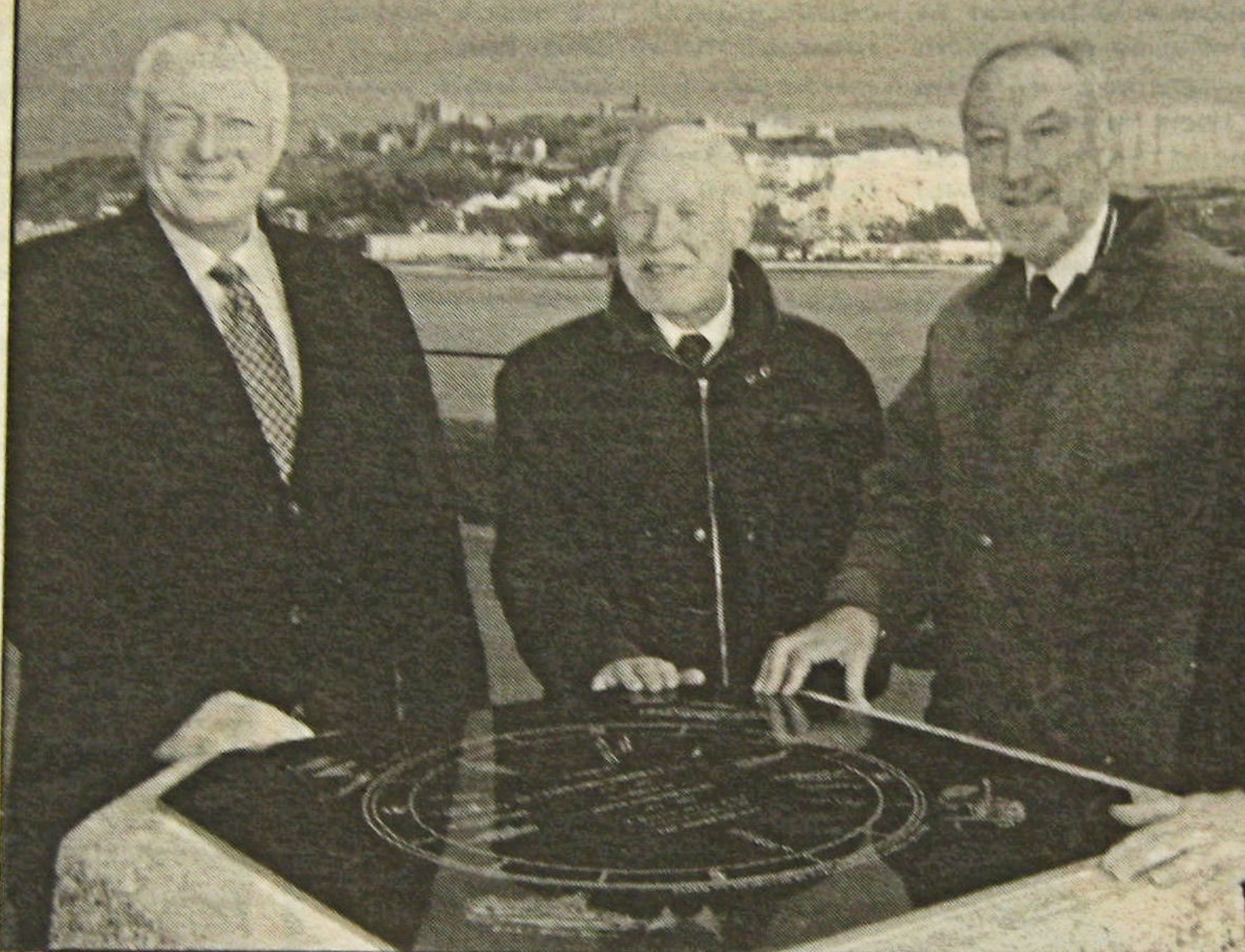
The unveiling of the refurbished Sir Clifford Jarrett (1909-1995) memorial – a former Chairman of DHB – on the Prince of Wales Pier, February 2005. Left to right, Bob Goldfield – the Chief Executive of DHB, middle and right – Dover Society’s Jeremy Cope and Derek Leach. Dover Mercury
By the summer of 2008 the proposed spending on the DWDR scheme was increased to £420million. Krayenbrink told this to those who attended the Annual Consultative Meeting that year, held at The Ark, Tower Hamlets. Regarding the waterway from Wellington Dock to the outer harbour, Krayenbrink said, it would be called The Cut and added that ‘There will be a navigable channel suitable for small craft similar to the existing one in Union Street (Wellington Dock gates and swing-bridge). There will be a need for dock gates and a bridge over the channel…’ Many other queries were raised, including where the lifeboat would be berthed. Krayenbrink told the audience that the marina would have two piers – east and west – that the West Marina Pier was the widened Prince of Wales Pier to enable lorries to go along it, therefore the lifeboat crew would not have any problems getting to the sea end, where the lifeboat berth would be. He added that the East Marina Pier would be topped with a wide walkway. How DHB were to pay for DWDR was also of concern, to which the Chief Executive, Bob Goldfield, told the audience, ‘In simple terms there are many options that are available to fund such a massive investment from pure debt financing, just like a normal bank loan, to selling the organisation to another body that has the money to deliver on the development … The Board have made no decision regarding the preferred funding option.’
Globally, an economic catastrophe was gaining momentum that put on hold the DWDR project and forced Goldfield and DHB to have to decide which of the two options or possible further options, they had to take. It would also affect Krayenbrink’s vision of the proposed Cut between Wellington Dock and the outer harbour. On the evening of Sunday 9 March 2008 in New York it became apparent that a number of large US banks had been caught up in leverage (lending) mania particularly in sub-prime mortgages and the borrowers were beginning to default. In other words, sub-prime borrowers credit ratings were so low they had a larger than average risk of defaulting as a percentage of bank lending – it was too high and borrowers were unable to pay back their loans. For the banking system to work, it relies on the equity provided by the bank’s investors and it is imperative that they have confidence in the safety of their investment. If the investors lose confidence then they will withdraw the bank’s equity and if there is an escalation of withdrawals, known as a run, the bank collapses. In other words, it is in danger of failing.
By Tuesday of that week, globally equities fell due to runs, Wall Street – the US financial centre – was in a state of panic as banking failure was spreading. On 22 April, the Royal Bank of Scotland (RBS) announced a rights issue which aimed to raise £12billion capital to offset a fall of £5.9billion. At the time, this was the largest rights issue in British corporate history. That summer, the money markets teetered as more banks failed. Then on Monday 15 September Lehman Brothers, the fourth-largest investment bank in the United States, failed and filed for bankruptcy. The next day, HBOS, which had formed out of a merger between Halifax Bank and the Bank of Scotland (not RBS), became the UK’s biggest victim of the banking crisis and the situation rapidly deteriorated. On Monday 6 October £90billion was wiped off the value of British firms as the recession hit. One week later, on 13 October the British government were forced into bailing out RBS by injecting £37 billion and taking up 58% of the Group.
DHB’s plans were put on hold while decisions were made as to what parts of the DWDR could be prioritised in relation to the possible finance available. With an annual turnover of about £60million and a £10-£12million operating profit, Krayenbrink told a Dover Society meeting in early 2010 that DHB had three options, they were:
1. Saving and borrowing – this, he said, would take too long and the government could refuse permission. NB, back in 1991, the government, with a view to privatisation, passed the Ports Act. This changed the status of DHB to that of a Trust Port and from that time it was known as the Port of Dover (the term DHB is retained for this story for ease of continuity). Thus, DHB became a Public Corporation and because of the recession the Treasury was restricting its borrowings.
2. The second option Krayenbrink mentioned was to sell 49% of the port. This, he said, would not attract investors and the government could keep the proceeds of the sale.
3. The third option was to sell 51% of the port, which was more attractive to investors as it would give the buyer overall control. DHB had estimated, he said, that the buyer would want a 12-15% return on their investment and this would be attractive to the government, especially as the country was in a deep recession. And they would retain all receipts from the sale.
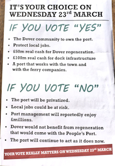
Referendum Poster over the possible privatisation of the Port – 23 March 2011. LS
In the event the DHB’s Board rejected option 1 as it ‘acts as an inhibitor to investment,’ and option 2 was similarly dismissed. Thus they went for option 3 and planned to create a wholly owned subsidiary company limited by shares. This was to be through a voluntary scheme under the Ports Act and would effectively result in the privatisation of DHB. In reaction a group of local businessmen and politicians launched an alternative option, that of Dover People’s Port Trust limited. Also using the 1991 Act, they planned to purchase DHB! This was contentious and dominated local news for a considerable period of time. To bring the wrangling to an end the People’s Port Trust called a Dover Town Referendum (Parish Poll) and this was held on Wednesday 23 March 2011. Only residents of Dover were allowed to vote and of those, only the ones who could attend. The question was, ‘Do you oppose the private sale of the Port of Dover as proposed by the Dover Harbour Board and support its transfer to the community of Dover instead?’ The poll took place between 16.00-21.00hrs and of those allowed to vote, 5,244 said yes, 113 said no. The Dover Society and the Trade Union – Unison conducted polls aimed at a wider local electorate. Their results echoed those of the official referendum.
DHB’s 1990s Advert stating that it was Working for and with the Community. LS
In the spring of 2010, DHB had submitted their DWDR proposal to the Secretary of State for Transport (June 2019 – May 2010) – Lord Andrew Adonis – for consideration. They were seeking a Harbour Revision Order (HRO), which would give the project the go ahead. In reality, their application was assessed by the Marine Management Organisation (MMO) – an executive non-departmental public body that under Section 14 of the Harbours Act 1964 such powers had been devolved. The Act stipulates that before approving an HRO, the MMO must be, ‘satisfied that the making of the order is desirable in the interest of securing the improvement, maintenance or management of the harbour in an efficient and economical manner or facilitating the efficient and economic transport of goods or passengers by sea or in the interests of the recreational use of sea-going ships’. When an HRO is being assessed for approval, organisations, companies and individuals, with an interest in the applicant port, can submit comments. With this in mind, DHB organised a public consultation during which time they hoped to deal with problems that could beset the HRO receiving approval.
For the 2011, DDC planning application, DHB had revised their 2006 DWDR plan in order to try and reduce the amount needed to finance the project by dividing it into two. Phase 1 appertained to the finance required for building Terminal 2, estimated to cost £120million. This included the four ferry berths, the filling in of Granville Dock and the Tidal Basin to create a lorry park and a yachting marina in the harbour. As part of Phase 1, the plan implied that Wellington Dock would become a tidal basin with The Cut through to the outer harbour. Phase 2 was to be for the more ‘fanciful’ (DHB description) aspects of the DWDR project, such as the Marina West Pier having accommodation for shops and restaurants. Later, in 2011 the MMO, with a few minor modifications, gave its approval and DHB turned its attention to raising the necessary private sector finance.
Towards the end of 2011, the DHB Board was restructured and Mike Krayenbrink decided to leave. According to the Dover Express (29.12.2011), he received a £300,000 handshake in addition to his £60,000 a year pension. Most of Krayenbrink’s department was transferred to DHB ‘Business and Support Services Directorate,’ headed by the Finance Director, Tim Waggott. Over the next couple of years the possibility of privatisation continued to rage. By May 2013 there was a new Harbour Board Chairman, George Jenkins, and that month Bob Goldfield stood down as Chief Executive. At about the same time, Stephen Hammond, the Ports and Shipping Minister, made it clear that ‘privatisation of the Port is history and proposals for a People’s Port was dead in the water.’

Tim Waggott Chief Executive DHB (2013-2018). Kent Live April 2017
Tim Waggott was appointed Chief Executive (2013-2018), and in June 2014, DHB applied to the MMO for the power to enter into joint ventures and borrow against assets. Within four months they received approval and at a public meeting, Waggott, told the audience that the MMO approval enabled the £120 million Phase 1 of Dover Western Docks Revival plan to progress. This, he said would ‘deliver over 600 new jobs for Dover and transforming the waterfront to be the catalyst for Dover’s wider regeneration.’ Jenkins then went on to announce that DHB were establishing a Community Fund for Dover and would launch it with a gift of £250,000 after that the Fund would annually receive 1% of DHB profits. That year the number of heavy goods vehicles going through Dover was 2,539,918 an increase of 129.39% since 1993!

Response by DHB Chief Executive Tim Waggott to Alan’s proposal of a Esplanade Navigational Cut to help alleviate Dover’s flood problems and to maintain Wellington Dock as a viable yachting marina.
Following the appointment of Tim Waggott as Chief Executive, Doverhistorian.com representative, Alan Sencicle, had spoken with him with regard to Dover’s flooding problems. This had centred on Alan’s plan of turning The Cut, or as Alan called it – Esplanade Navigational Cut – between Wellington Dock and the outer harbour, into both a navigable and a flood prevention facility. As Chief Executive, Waggott invited Alan to come to Harbour House to discuss his project with the meeting taking place in July 2014. Alan told Waggott that Dover’s flood problems could be reduced by incorporating specially designed lock gates in the proposed Esplanade Navigational Cut. Further, not only would they help to alleviate Dover’s flood problems but would enable Wellington Dock to remain a significant part of a viable yachting marina. He went on to say that he had written a paper on the proposal and Waggott, who had shown interest, asked for a copy. Later, Alan described the meeting as positive and sent Waggott a copy of his paper with copies to the Dover Society and to Dover District Council.
It was not until September that Waggott responded, but he did say that he could confirm that following the concerns Alan had raised, the newly proposed navigational access to the Wellington Dock included arrangements for dealing with tidal surges and flood prevention. He added that, Data had been collated and examined from a variety of sources including DDC’s Strategic Flood Risk Assessment and a hydraulic modelling assessment of the River Dour. Waggott finished by saying that the ‘flood attenuation issues will form part of our future design and we will seek such central funding as required in due course.’ We were delighted with the response especially as work on the DWDR project in August, with the demolition of Fast Ferry (catamaran) berth at the former Hoverport had started. This indicated that work on the Esplanade Navigational Cut might start in the foreseeable future!

Eastern Docks on a typical busy day. The 6 acre lorry apron is the rectangle to the right of Jubilee Way. DHB 2015
DHB sought Planning Permission from DDC in 2015 for their Revised DWDR project, making it clear that it was aimed at easing the pressure on the Eastern Docks of heavy vehicles. Waggott told a Dover Society meeting that the cargo terminal at Eastern Docks covered 6acres and that by moving it to Western Docks, it could double in size. He went on to say that Dover was the busiest port in the UK with a shipping movement every 10minutes, usually from Eastern Docks. The Eastern Docks were also the fourth largest facility for the number of passengers after Gatwick, Heathrow and Manchester airports and at that time the docks were halfway through an £85million improvement scheme.
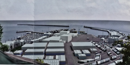
Western Docks proposed Cargo terminal. DHB
To deal with moving the cargo terminal from Eastern Docks and the continual rise in the amount of freight through the port, DWDR plans were changed to create a large cargo terminal, with warehousing and packaging facilities. They also planned the site to accommodate facilities for haulage and delivery, together with component assembly provisions, construction, stevedoring, engineering and training accommodation. This increased the amount of shore space needed and therefore waterfront/marina facilities were to be reduced accordingly. The new proposal, DHB claimed, would cost £250million and was scheduled to open in 2019. The contractors for the new scheme were Graham’s Contractors Ltd, Walton, Preston, Lancashire.
The proposal brought wry smiles to the faces of many Dovorians as it was reminiscent of the post-war Eastern Dockyard, which was a successful light industrial zone. That is until 1953, when DHB turned it into a specialised Car Ferry Terminal and renamed the site Eastern Docks. This forced the firms operating there to move elsewhere, causing anger and a local rise in unemployment. That fiasco is mentioned in the section above as is the Old Park Estate saga. When in 1997, following the EC introducing the Single Market three years before, the number of lorries coming through Dover had increased by 44.67%, DHB bought the 225acre Old Park Estate. This was to create a Port Zone which provided lorry parking and a number of associated port industries, similar to those cited in the 2015 Revised DWDR project. To help to pay for the project, the government gave DHB a £½million grant and the EC gave a further grant to create a lorry friendly access from Whitfield Hill to the proposed Port Zone. However, by 2005, DHB had sold off over two-thirds of the Estate for housing and was looking at Farthingloe, for a possible lorry park! Hence, the 2015 Revised DWDR plans were seen as deja vu!
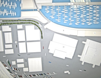
DHB Western Docks 2014 proposal showing The Cut (6) without an incorporated flood barrier. AS
Looking at the planning application, it was evident to Alan that The Cut was no different to that which had been shown in an artist’s model of the scheme, produced the year before. The Cut only had a basic gate that separated the Wellington Dock water level from the proposed marina sea level but did not incorporate a flood barrier. Alan tried to speak to Waggott but he seemed to be disinterested. However, as a member of the Dover Society planning committee, Alan was able to explain to them his concerns over the lack of a flood barrier in the new scheme. The Chairman, Patrick Sherratt, wrote to Tim Waggott with copies to appropriate Parliamentary Ministers, requesting them all to give serious consideration to Alan’s proposed flood alleviation scheme.
In the same Planning Application it stated that Granville Dock and the Tidal Basin would be reclaimed by the use of sand to create a lorry park. The amount of sand was 2.5 million cubic metres and it was to be dredged from the Goodwin Sands, a 10mile-long sand bank off the east coast of Kent in the English Channel. To do so required DHB to submit an HRO. This they did, with the expectation that the MMO would give permission without equivocation. This aspect of the Application became public knowledge and the Save Our (Goodwin) Sands pressure group was set up, launching their campaign against the proposal.
DHB submitted another Planning Application in the spring of 2016 that included a request for consent to alter the Listed Wellington Dock Esplanade Quay. This, it said, was to provide access from the New Marina to Wellington Dock, through The Cut. It was evident by the description that The Cut was no different from that seen in the 2014 artist’s model and that it still did not incorporate a flood barrier. Another part of this application covered the proposed construction of new public lavatories on the Esplanade, near the proposed Cut. The Environment Agency opposed the application, pointing out that the toilets would be subject to flooding – DHB subsequently modified the plans.
The Dover Express contacted DHB to be told that The Cut would not go ahead until Phase 2 of development had been completed. This was because they (DHB) were relying on partners to pay for it and as it was unlikely to be profitable, partners would not be interested. At about this time a vacancy had occurred on the DHB Port and Community Forum (PCF) chaired by Derek Leach, the Chairman of the Dover Society. Founded in 2014 the PCF’s objective was to provide local community input into DHB proposed schemes with the aim ‘to implement projects with benefit to Dover and the Port itself.’ Alan applied to join the PCF and included details of his flood alleviation proposal but failed to receive the support necessary from the existing committee members. Apparently his flood alleviation plans were not considered to be of any benefit to Dover and the Port itself, as required by the PCF aims!

Brexit-themed mural by Banksy facing the Continental side of the A20 on the corner of York Street – Snargate Street. May 2017. Kent Messenger
On Thursday 23 June 2016, the people of the United Kingdom went to the polls to vote on whether the country should remain a member of the European Union (EU) in a National Referendum. For the vote, Dover, Deal and surrounding areas including part of Sandwich were grouped together. Feelings on the issue were strong and DHB ran forums justifying staying in the EU arguing that leaving would be detrimental to Dover’s economy. Some members of the PCF loudly supported DHB’s stance and their campaigning was fierce. Those who actively supported the Leave campaign (Brexit) in the Dover area put great emphasis on the heavy goods vehicles going to and from the Continent blocking Dover’s roads, polluting the air and as they were mainly bringing goods from the Continent, they were forcing locals to take low paid unskilled jobs and killing industry in general. The local turnout on the day was 76.5% = 65,016 of the local population. Of these, 62.2% = 40,410 voted to Leave and 37.8% = 24,606 voted to Stay. In the county of Kent the turnout was 76% = 973,177 people. 59.2% = 576,587 voted to Leave and 40.8% = 396,590 voted to Stay.

DHB advert against the Save the Goodwins campaign from sand dredging for the Western Docks project. Sept 2016
Totally unconnected with the Referendum, anger against the dredging of the Goodwin Sands had escalated such that approximately 11,000 people had signed a petition against the project. DHB reacted by paying for full page adverts warning Dover people and such organisations as the Save Our (Goodwin) Sands to stop objecting as this was detrimental to Dover. It was expected by both DHB and the PCF that the MMO would agree to DHB’s dredging application. Instead the MMO made it clear that there was a statutory 42-day consultation period for public consultation and this began in June 2016. Due to the high level of public interest the consultation period was extended and then MMO requested further information from DHB giving them until 16 November 2016 to respond. The objectors main concern were anomalies in the dredging zone while the Ministry of Defence, through the MMO, required DHB to undertake research and supply information regarding the location of military air crash sites. Permission was eventually granted for infill material to be dredged from a designated site – Area 501, in the North Thames Estuary. Away from the Goodwins and from where DHB had planned to dredge.
Following this outcome and possibly in combination with the Referendum result, there was a total change of attitude by DHB. In January 2017, they appointed VolkerStevin construction and civil engineering company of Preston, Lancashire and Boskalis Westminster dredging company of Fareham, Hampshire, in a joint contract – VSBW – valued at £115 million. This was for the design and build of two new cargo berths including quay walls and land reclamation, a new marina pier, the marina curve … and a navigation channel with new lock gates, bridge and capital dredging work! Details showed that Alan’s paper on the Esplanade Navigational Cut had been taken into account and Waggott confirmed this!
5. Esplanade Navigational Cut – Alan Sencicle’s proposal
Back in July 2014, following the discussion between Alan Sencicle, as a member of the Doverhistorian.com team, and DHB Chief Executive, Tim Waggott, the latter was given a copy of the paper that he had written. This was for the provision of a both a navigable channel and a flood prevention facility from Wellington Dock to the outer harbour. Alan had made it clear to Waggott that he envisaged the lock would be part of the Dover Western Docks Revival (DWDR) scheme (see above). Copies of the paper were initially sent to Dover District Council and the Dover Society but later to relevant Ministers, the Environment Agency and the local media.
Alan’s proposal specifically focussed on The Cut, or as Alan called it in his plan – the Esplanade Navigational Cut – between Wellington Dock and the outer harbour. He argued that the lock should be purposely designed and fitted with suitably designed gates that could hold back exceptionally high tides. Finally, but crucially, the retaining walls must be built such they are higher than the highest possible predicted sea levels. Alan wrote that there were a number of ways that this may be achieved including:

Kiel Canal lock transverse lock gate that slides in and out of a recess to the side of the lock structure
– Duplicated mitre gates, similar to the present Wellington Dock gate, at the seaward end of the lock only. One pair to face in towards the dock and the other pair facing out towards the outer harbour.
– A transverse gate at the seaward end of the lock sliding in and out of a recess to the side of the lock structure, able to seal in both directions according to the state of the tide. This design of gate maximises the size or numbers of vessels that can pass through the lock for the minimum construction cost. The Kiel Canal locks incorporate such a design.
– If a basic lock were to be provided with two sets of mitre gates designed to retain dock water levels. A stopgate could be provided that would need to be inserted and removed by crane at times of predicted high tides likely to result in flooding. Such a stopgate would be situated between the mitre gates and the sea. If a second stopgate facility were to be incorporated beyond the mitre gates at the dock end of the new cut, then maintenance of all the dock gates could be carried out without the need to drain the dock. This has never been possible with the existing dock gates.
– The cheapest option would consist of no more than a single pair of mitre gates designed to maintain dock water levels over the low water period. Even then a stopgate facility should be installed either side for both flood prevention and for maintenance.
– A hinged gate on the seaward side of the lock that would lie flat on the bottom but capable of being raised to the vertical at times when high tides are predicted. This design was incorporated into the Train Ferry Dock opened in 1936 – see that story for a full description. The Thames Barrier is a development of this design.
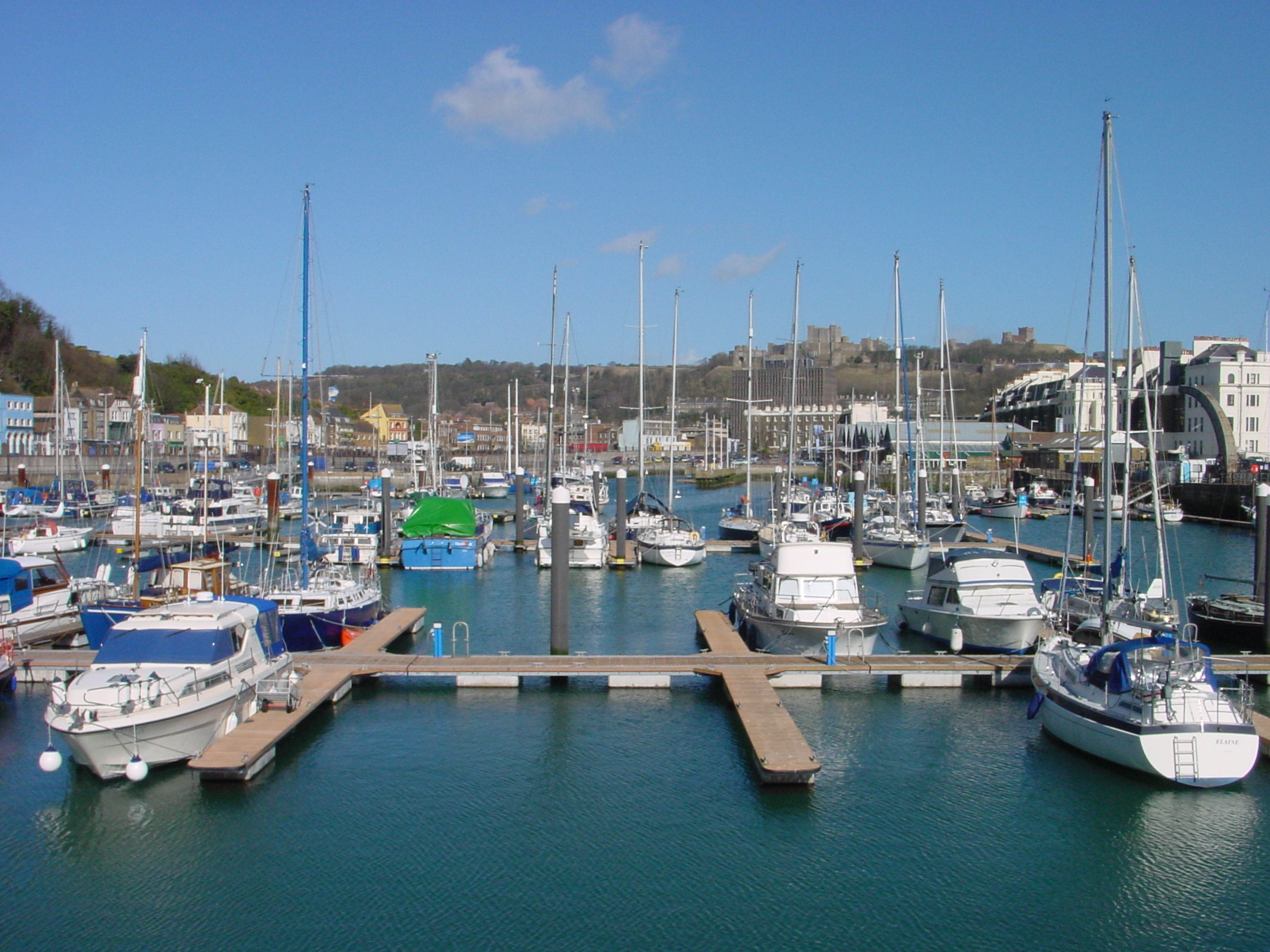
Wellington Dock 2009. AS
Alan calculated the area of the Wellington Dock to be of the order of 32,650 square metres. Within such an area, a change in water level of only 1 metre equated to 32,650 tonnes or 32.65 million litres. He had studied water flows in the River Dour and estimated normal flow rates to be of the order of 2000 tonnes per hour (0.55 cubic metres per second, 550 litres per second) into the Wellington Dock. Maximum flow rates coincident with exceptionally high tides could be of the order of 10,000 tonnes per hour. It was likely that additional groundwater was finding its way into the dock and that the figures could be verified by closing the existing sluice gates over a low water period and monitoring the rate of rise of water level for both high and low river flows.
He went on to say that when required the new lock and its associated sluices could be used to lower the water level in the dock during the low water period. 1 to 1½ metres lowering of level could be all that was required to prevent any possible risk of flooding. If a suitable facility was incorporated into the Esplanade Navigational Cut to hold back exceptionally high tides. Then with the dock level lowered and all sluices closed, the flow from the river Dour and any other fresh water ingress would result in a controlled increase in level without any potential for flooding. Alan added that he could not see a requirement for the lock gates and sluices to be closed for more than 1½ hours either side of high water.
Thus, he wrote, there should be significant benefits of such a scheme for the Dover Harbour Board. The Environment Agency could save money on future flood prevention schemes as sea levels continue to rise as a result of climate change. Finally areas of the town blighted by the threat of flooding could also be made available for development such as the site that was previously proposed for a Community Hospital on the former site of Brook House site between Maison Dieu Road and the river Dour.
6. The Esplanade Navigational Channel
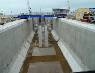
Base and sides of the Esplanade Navigational Channel. AS Nov 2018
The go-ahead for the Esplanade Navigational Channel, as it has been named, was given in January 2017 and Waggott told Alan that his ideas had been incorporated into the design. By May 2018 the channel had been dug out and the information panels showed that the lock gates opened outwards towards the sea as opposed to the existing Wellington Dock mitre dock gates opened inwards towards the dock.
In January 2019 Doverhistorian.com received notification that a single leaf bascule bridge and marina lock gates for the Esplanade Navigational Channel had arrived. A bascule bridge is the most common type of moveable span bridges and the name is derived from the French term for balance scale. In essence, the bridge goes up and down with a counterweight that continuously balances its span throughout its upward swing. They can either be single leaf – as the one that will span the Esplanade Navigational Channel – or double, such as Tower Bridge, London. The DHB bridge has been designed and manufactured by the Engineering Company, Qualter Hall of Barnsley and the remit states that the bridge has to maintain vehicular and pedestrian access along the Esplanade.
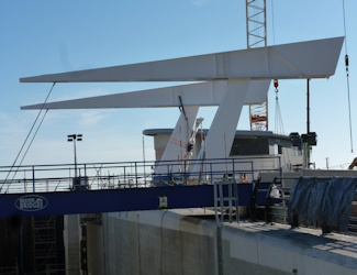
Esplanade Navigational Lock single leaf bascule bridge. The pivoting arms sit on top of masts designed to look like ships masts. AS 2019
Tie bars attach the bascule bridge deck to a pivoting arm, which sits on top of a pair of masts, designed to represent ships masts. The deck is lifted using hydraulic cylinders attached to the pivoting frame. The lifting mechanism is assisted by a steel filled counterweight section at the end of the balance arm. The deck is 16metres in length, 15.1metres in width and weighs 96 tonnes. It has a mast height of 16metres and was brought in by a sea-going barge from the fabricator, Victor Buyck Steel Construction, Oost-Vlaanderen (East Flanders), Belgium. It was lifted into place by a land-based crane with 1,250 tonne lifting capacity.
At about the same time as the bascule bridge sections had arrived so had the lock gates, two pairs. The Esplanade Navigational Channel is designed to have 2 mitre lock gates and 2 sector lock gates and it is expected that they will provide 24-hour access for marine craft. That is with the exception of extreme high tides and storm surge conditions, when the outer, sector lock gates will be shut to prevent flooding.
– The 2 Mitre gates will be located in the middle of the navigational channel adjacent to the bascule bridge. Mitre lock gates are the most common sea gates in use – the gates at the present entrance to the Wellington Dock are of this design. They require the level of water to be the same at both sides before they will open and consist of two leaves, the combined lengths of which exceed the width of the lock. When the lock is open, the leaves are housed in lock wall recesses and when closed, after turning through about 70°, they meet on the lock’s central axis in a V shape pointing towards Wellington Dock. In the case of the Navigational Channel, the 2 mitre gates are 6metres high, 5.5metres wide and each weigh 13 tonnes. The height is 6 metres lower than that of the sector gates in order to maintain a working level within the Wellington Dock.
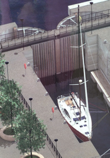
Esplanade Navigational Lock Sector lock gates – artist impression – designed to open outwards. AS 2018
– The 2 Sector gates will be located at the seaward entrance of the Esplanade Navigational Channel and are much more complex and expensive than the mitre lock gates. They are capable of opening even when the water levels and operating loads on either side are different. Because of their shape the water loads are transferred directly to the pivot which reduces friction and they are able to seal in both directions when shut. When open, like mitre gates, the leaves are housed in lock wall recesses. They are 12metres high and each weigh 50 tonnes. The most important thing about them is that the crest of the gates and the adjacent concrete structure has been designed to hold back sea levels as high as +9.5 metres above Ordnance Datum. In other words they are designed to provide flood prevention during extreme high tide and storm surge conditions and they take account any further increase in sea levels, well into the future.
Doverhistorian.com’s Alan Sencicle’s determination has paid off!
Presented: 14 February 2019
